
MyTopo
Big Rush Lake Minnesota US Topo Map
Couldn't load pickup availability
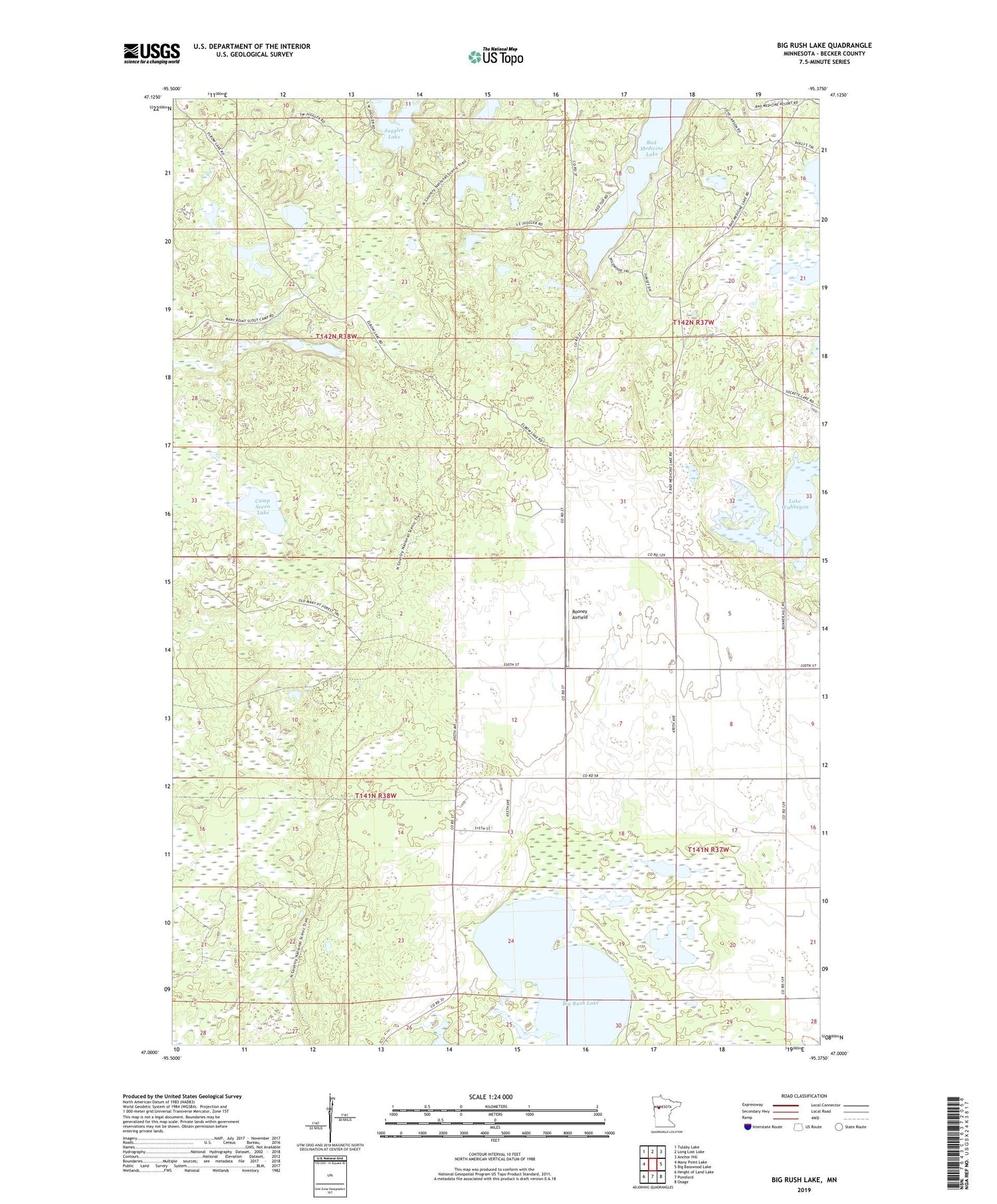
2019 topographic map quadrangle Big Rush Lake in the state of Minnesota. Scale: 1:24000. Based on the newly updated USGS 7.5' US Topo map series, this map is in the following counties: Becker. The map contains contour data, water features, and other items you are used to seeing on USGS maps, but also has updated roads and other features. This is the next generation of topographic maps. Printed on high-quality waterproof paper with UV fade-resistant inks.
Quads adjacent to this one:
West: Many Point Lake
Northwest: Tulaby Lake
North: Long Lost Lake
Northeast: Anchor Hill
East: Big Basswood Lake
Southeast: Osage
South: Ponsford
Southwest: Height of Land Lake
Contains the following named places: Big Rush Lake, Camp Seven Lake, Kneebone Lake, Lake Wahbegon, Rooney Airfield, Township of Round Lake, ZIP Code: 56575


