MyTopo
Long Lost Lake Minnesota US Topo Map
Couldn't load pickup availability
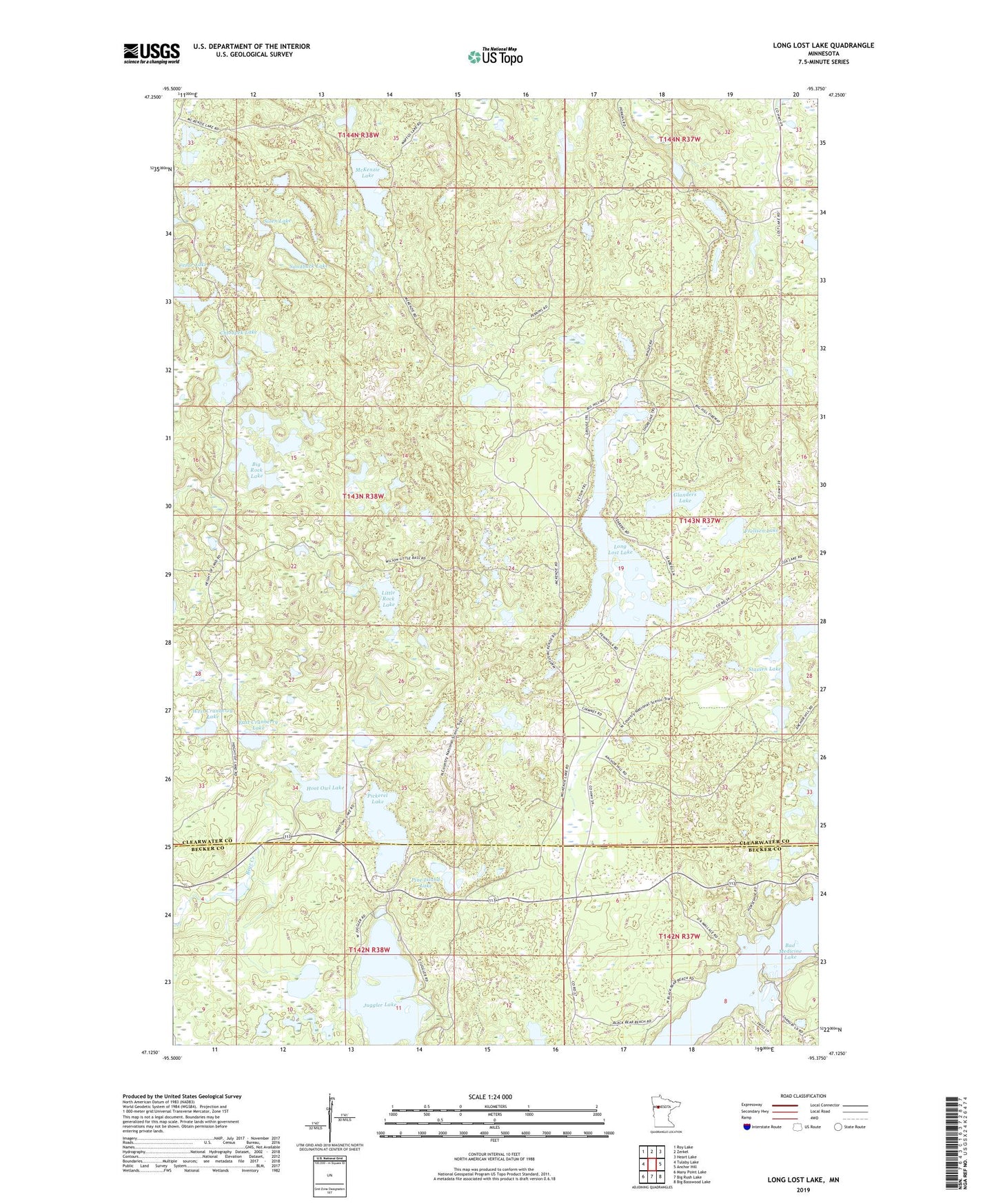
2022 topographic map quadrangle Long Lost Lake in the state of Minnesota. Scale: 1:24000. Based on the newly updated USGS 7.5' US Topo map series, this map is in the following counties: Clearwater, Becker. The map contains contour data, water features, and other items you are used to seeing on USGS maps, but also has updated roads and other features. This is the next generation of topographic maps. Printed on high-quality waterproof paper with UV fade-resistant inks.
Quads adjacent to this one:
West: Tulaby Lake
Northwest: Roy Lake
North: Zerkel
Northeast: Heart Lake
East: Anchor Hill
Southeast: Big Basswood Lake
South: Big Rush Lake
Southwest: Many Point Lake
This map covers the same area as the classic USGS quad with code o47095b4.
Contains the following named places: Andrews Lake, Bad Medicine Lake, Big Rock Lake, Cesar Lake, Chloupek Lake, East Cranberry Lake, Frellsen Lake, Glanders Lake, Hoot Owl Lake, Juggler Lake, Little Rock Lake, Long Lost Lake, McKenzie Lake, Pickerel Lake, Pine Island Lake, Sandback Lake, Shuckhart Lake, Siren Lake, Stassen Lake, West Cranberry Lake