MyTopo
Tulaby Lake Minnesota US Topo Map
Couldn't load pickup availability
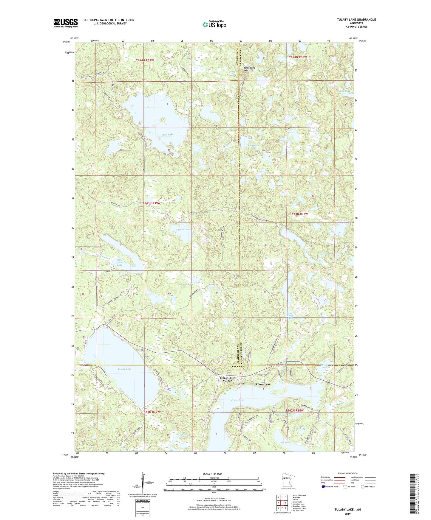
2022 topographic map quadrangle Tulaby Lake in the state of Minnesota. Scale: 1:24000. Based on the newly updated USGS 7.5' US Topo map series, this map is in the following counties: Mahnomen, Clearwater, Becker. The map contains contour data, water features, and other items you are used to seeing on USGS maps, but also has updated roads and other features. This is the next generation of topographic maps. Printed on high-quality waterproof paper with UV fade-resistant inks.
Quads adjacent to this one:
West: Snider Lake
Northwest: North Twin Lake
North: Roy Lake
Northeast: Zerkel
East: Long Lost Lake
Southeast: Big Rush Lake
South: Many Point Lake
Southwest: Strawberry Lake
This map covers the same area as the classic USGS quad with code o47095b5.
Contains the following named places: Bass Lake, Bear Creek, Bottom Creek, Calvary Church, Elbow - Tulaby Lakes Fire Department, Elbow Lake, Elbow Lake Census Designated Place, Elbow Lake Village, Height of Land Lookout Tower, Horseshoe Lake, Johnson Lake, Jolly Fisherman Seaplane Base, Little Bass Lake, Little Elbow Lake, Little Elbow Lake State Park, Lower Camp Lake, Luethi Lake, Moore Lake, Pike Lake, Pike Lake Resort Campground, Saint Frances Cabrini Church, Sawmill Lake, Schantzen Lake, Scoop Lake, Strawberry Mountain, Stump Lake, Township of Little Elbow, Tulaby Lake, Tulaby Lake Rest Area, Unorganized Territory of Southeast Mahnomen, Upper Camp Lake, Wilson Lake, ZIP Code: 56566