MyTopo
Osage Minnesota US Topo Map
Couldn't load pickup availability
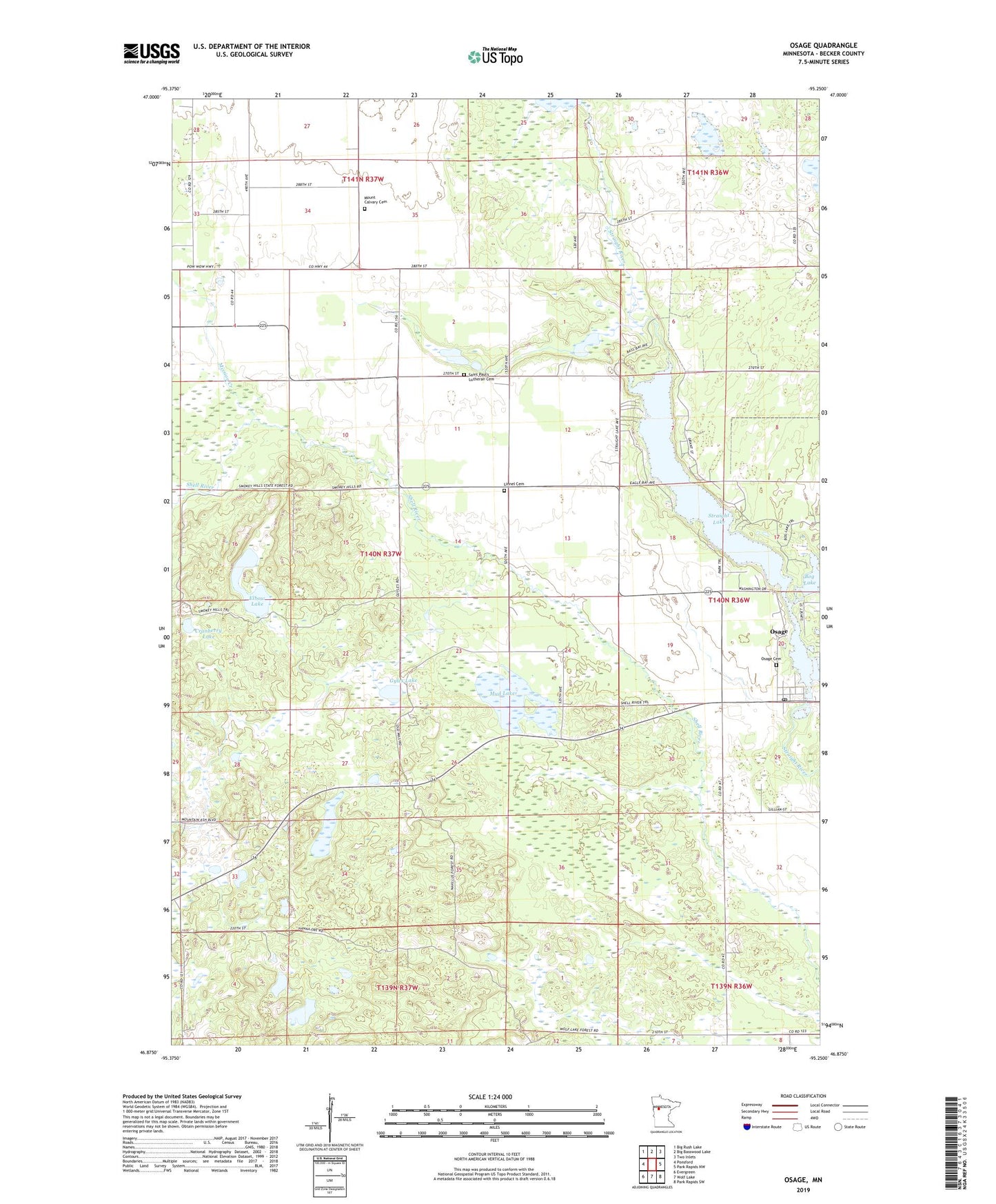
2022 topographic map quadrangle Osage in the state of Minnesota. Scale: 1:24000. Based on the newly updated USGS 7.5' US Topo map series, this map is in the following counties: Becker. The map contains contour data, water features, and other items you are used to seeing on USGS maps, but also has updated roads and other features. This is the next generation of topographic maps. Printed on high-quality waterproof paper with UV fade-resistant inks.
Quads adjacent to this one:
West: Ponsford
Northwest: Big Rush Lake
North: Big Basswood Lake
Northeast: Two Inlets
East: Park Rapids NW
Southeast: Park Rapids SW
South: Wolf Lake
Southwest: Evergreen
This map covers the same area as the classic USGS quad with code o46095h3.
Contains the following named places: Basswood Bay Resort Campground, Bog Lake, Bottomless Lake, Cranberry Lake, Elbow Lake, First Baptist Church of Osage, Gyles Lake, Linnel Cemetery, Linnell Post Office, Mission Creek, Mount Calvary Cemetery, Mud Lake, Osage, Osage Cemetery, Osage Census Designated Place, Osage Post Office, Osage School, Pine Grove Roadside Park, Saint Pauls Church, Saint Paul's Lutheran Cemetery, Smoky Hills Lookout Tower, Straight Lake, Straight Lake Dam, Township of Carsonville, ZIP Code: 56570