MyTopo
Big Stone Lake East Minnesota US Topo Map
Couldn't load pickup availability
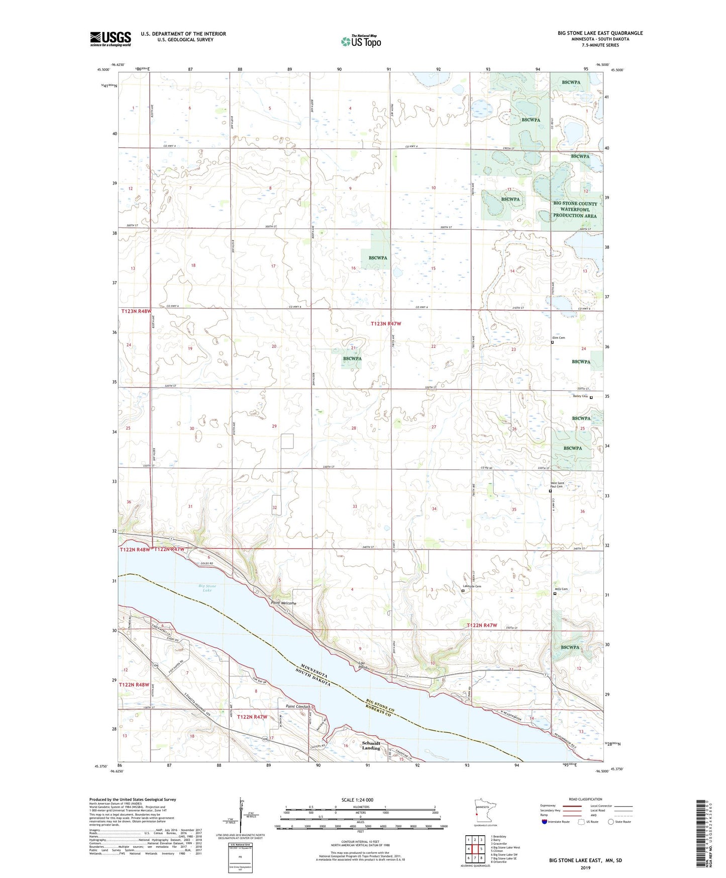
2022 topographic map quadrangle Big Stone Lake East in the states of Minnesota, South Dakota. Scale: 1:24000. Based on the newly updated USGS 7.5' US Topo map series, this map is in the following counties: Big Stone, Roberts. The map contains contour data, water features, and other items you are used to seeing on USGS maps, but also has updated roads and other features. This is the next generation of topographic maps. Printed on high-quality waterproof paper with UV fade-resistant inks.
Quads adjacent to this one:
West: Big Stone Lake West
Northwest: Beardsley
North: Barry
Northeast: Graceville
East: Clinton
Southeast: Ortonville
South: Big Stone Lake SE
Southwest: Big Stone Lake SW
Contains the following named places: Bailey Cemetery, Big Stone Lake, Big Stone Lake State Park, Elim Cemetery, Finberg State Wildlife Management Area, Kasuske Public Access Point, Lakeside Cemetery, Lockwood, Lou Point, Mills Cemetery, Point Comfort, Point Welcome, Schmidt Landing, School Number 2, Shannon Field Airport, Township of Prior, West Saint Paul Cemetery