MyTopo
Beardsley Minnesota US Topo Map
Couldn't load pickup availability
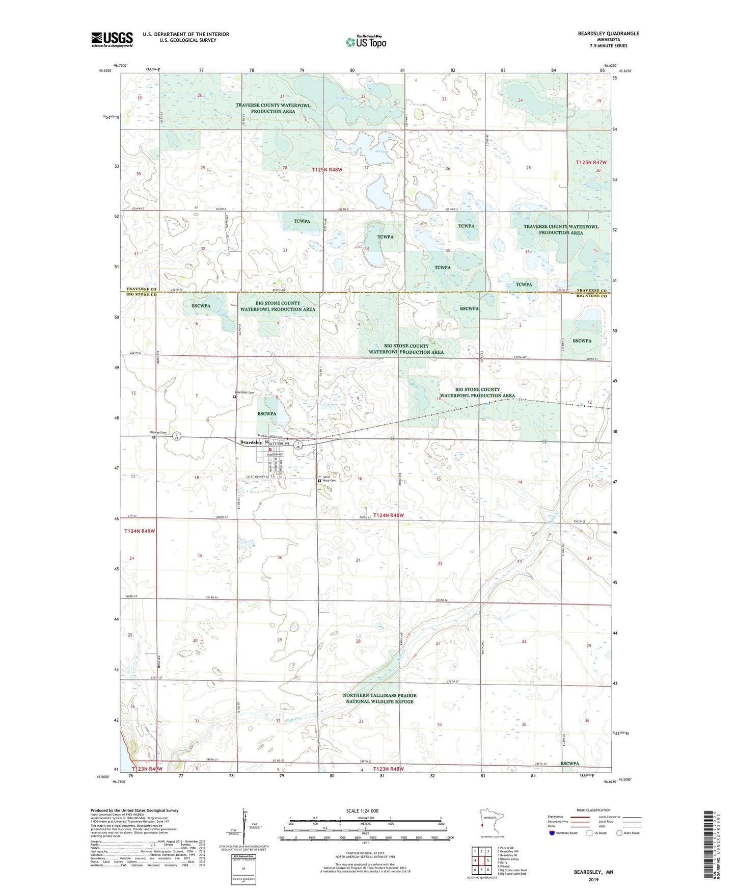
2022 topographic map quadrangle Beardsley in the state of Minnesota. Scale: 1:24000. Based on the newly updated USGS 7.5' US Topo map series, this map is in the following counties: Big Stone, Traverse. The map contains contour data, water features, and other items you are used to seeing on USGS maps, but also has updated roads and other features. This is the next generation of topographic maps. Printed on high-quality waterproof paper with UV fade-resistant inks.
Quads adjacent to this one:
Northwest: Peever NE
North: Beardsley NW
Northeast: Beardsley NE
East: Barry
Southeast: Big Stone Lake East
South: Big Stone Lake West
Southwest: Wilmot
This map covers the same area as the classic USGS quad with code o45096e6.
Contains the following named places: Beardsley, Beardsley Cemetery, Beardsley Fire Department, Beardsley Methodist Church, Beardsley Police Department, Beardsley Post Office, Beardsley Village Hall, Bethlehem Lutheran Church, CGB Elementary School, City of Beardsley, County Ditch Number Seven, Fish Creek School, Flood Slough, Hilo School, Kinney School, Midway Cemetery, Saint Mary Cemetery, Saint Mary's Catholic Church, Theake School, Township of Browns Valley, Traverse County Waterfowl Production Area, Wet Lake, Wyman School, ZIP Code: 56211