MyTopo
Bovey Minnesota US Topo Map
Couldn't load pickup availability
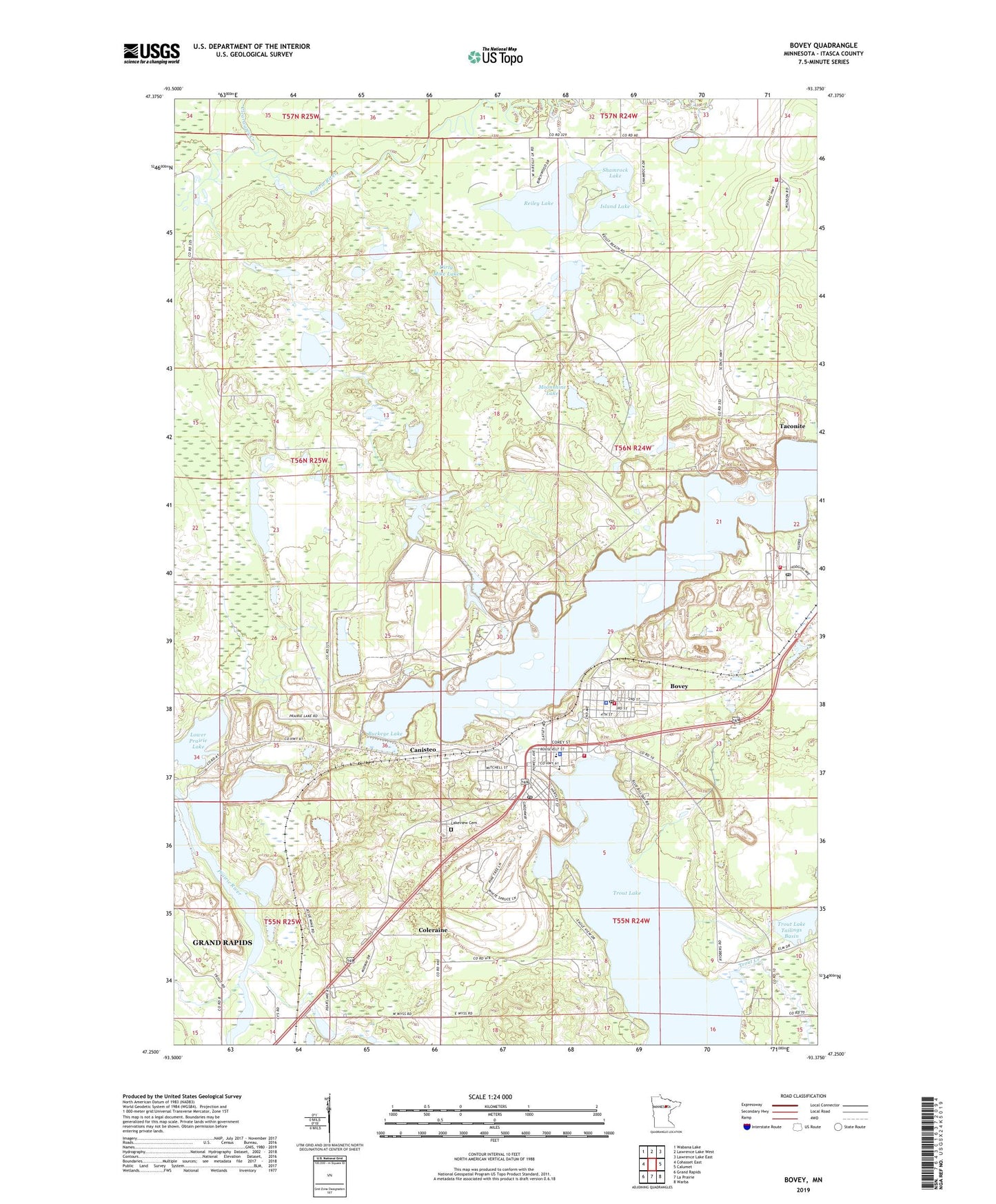
2019 topographic map quadrangle Bovey in the state of Minnesota. Scale: 1:24000. Based on the newly updated USGS 7.5' US Topo map series, this map is in the following counties: Itasca. The map contains contour data, water features, and other items you are used to seeing on USGS maps, but also has updated roads and other features. This is the next generation of topographic maps. Printed on high-quality waterproof paper with UV fade-resistant inks.
Quads adjacent to this one:
West: Cohasset East
Northwest: Wabana Lake
North: Lawrence Lake West
Northeast: Lawrence Lake East
East: Calumet
Southeast: Warba
South: La Prairie
Southwest: Grand Rapids
Contains the following named places: Arcturus Tailings Basin, Arcturus Tailings Dike, Arcturus Water Supply Basin, Arcturus Water Supply Dike, Bethel - Trinity Lutheran Church, Bingham Mine, Bovey, Bovey City RV Park, Bovey Fire Department, Bovey Police Department, Bovey Post Office, Bovey Public Library, Bovey School, Brown Mine, Buckeye Lake, Buckeye Mine, Buckeye Two Tailings Basin, Buckeye Two Tailings Dike, Canisteo, Canisteo Mine, City of Bovey, City of Coleraine, City of Taconite, Clearwater Creek, Coleraine, Coleraine Fire Department, Coleraine Police Department, Coleraine Police Station, Coleraine Post Office, Coleraine Public Library, Danube Mine, Dirty Mike Lake, Eagle Ridge Golf Course, First Presbyterian Church, Greenway High School, Greenway Public School, Holman Cliffs Mine, Hunner Tailings Basin, Hunner Tailings Dike, Island Lake, Jessie Mine, Judd Mine, KAXE-FM (Grand Rapids), King Mine, KMFY-FM (Grand Rapids), Kom-on-In Beach Campground, Lakeview Cemetery, Little Reiley Lake, Mary Immaculate Church, Moonshine Lake, Morrison Mine, Mount Itasca Ski Area, Mount Olive Lutheran Church, North Star Mine, Orwell Mine, Philip Murray Elementary School, Prairie River Dam, Reiley Lake, Sally Mine, Shamrock Lake, South Judd Mine, Taconite, Taconite Fire Department Station 1, Taconite Fire Department Station 2, Taconite Post Office, Township of Iron Range, Trout Lake, Trout Lake Tailings Basin, Trout Lake Tailings Dike, Vandyke Elementary School, Walker Mine, West Hill Mine, ZIP Codes: 55722, 55786