MyTopo
Bradford Minnesota US Topo Map
Couldn't load pickup availability
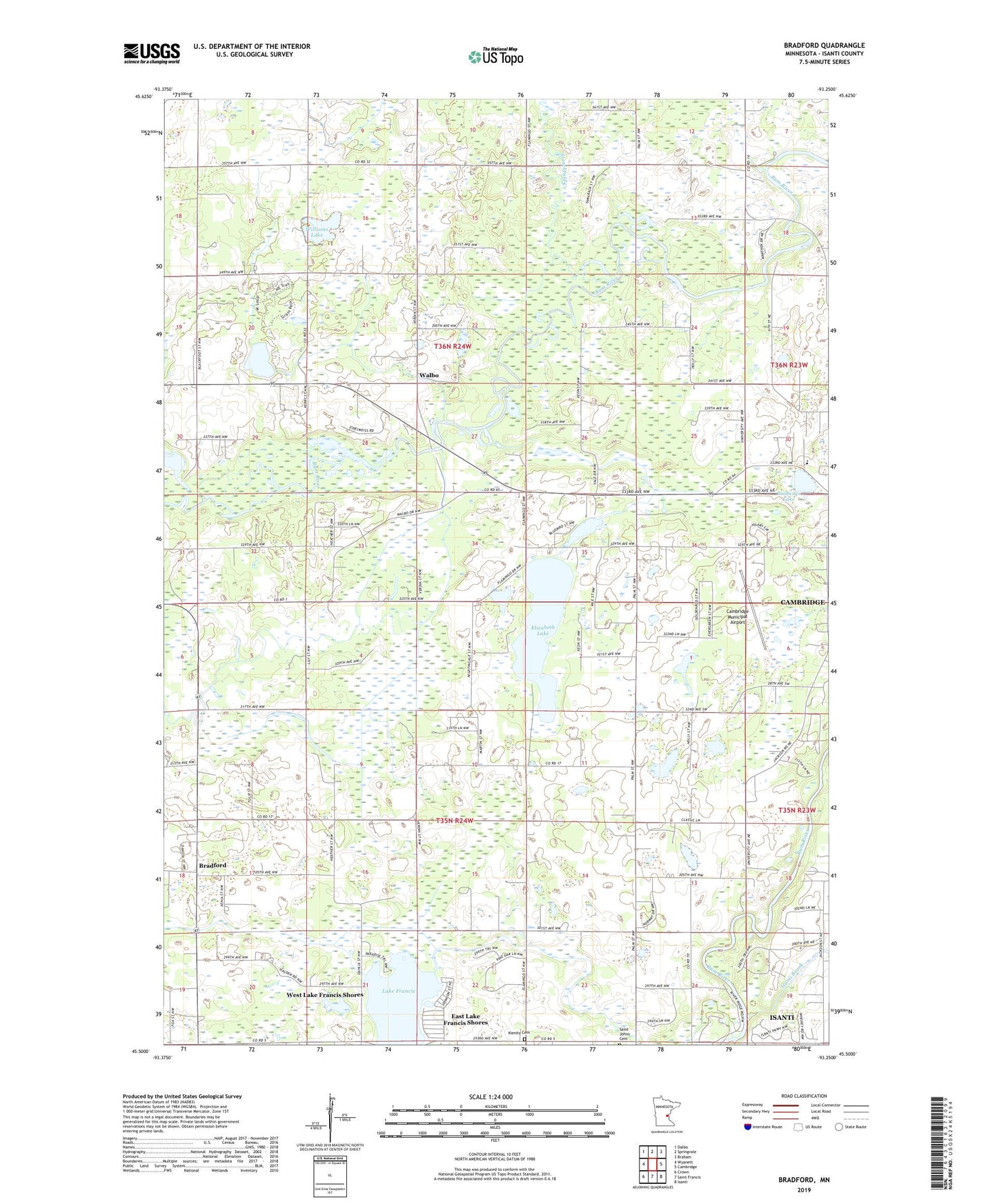
2019 topographic map quadrangle Bradford in the state of Minnesota. Scale: 1:24000. Based on the newly updated USGS 7.5' US Topo map series, this map is in the following counties: Isanti. The map contains contour data, water features, and other items you are used to seeing on USGS maps, but also has updated roads and other features. This is the next generation of topographic maps. Printed on high-quality waterproof paper with UV fade-resistant inks.
Quads adjacent to this one:
West: Wyanett
Northwest: Dalbo
North: Springvale
Northeast: Braham
East: Cambridge
Southeast: Isanti
South: Saint Francis
Southwest: Crown
Contains the following named places: Bar-L Ranch Country Club, Becklin Homestead Park Wildlife Management Area, Bradford, Bradford Post Office, Bradford School, Brobergs Lake, Calvary Baptist Academy, Calvary Baptist Church, Cambridge Municipal Airport, Dowling School, East Bradford Cemetery, East Lake Francis Shores, Elizabeth Lake, Isanti Brook, Isanti County, Lake Elizabeth Game Refuge, Lake Francis, Maywood County Park, Saint Johns Church, Saint John's German Lutheran Cemetery, Springvale County Park, Stanchfield Creek, Township of Bradford, Township of Springvale, Walbo, Walbo Post Office, West Lake Francis Shores, Westbriar County Park, Williams Lake, ZIP Code: 55008