MyTopo
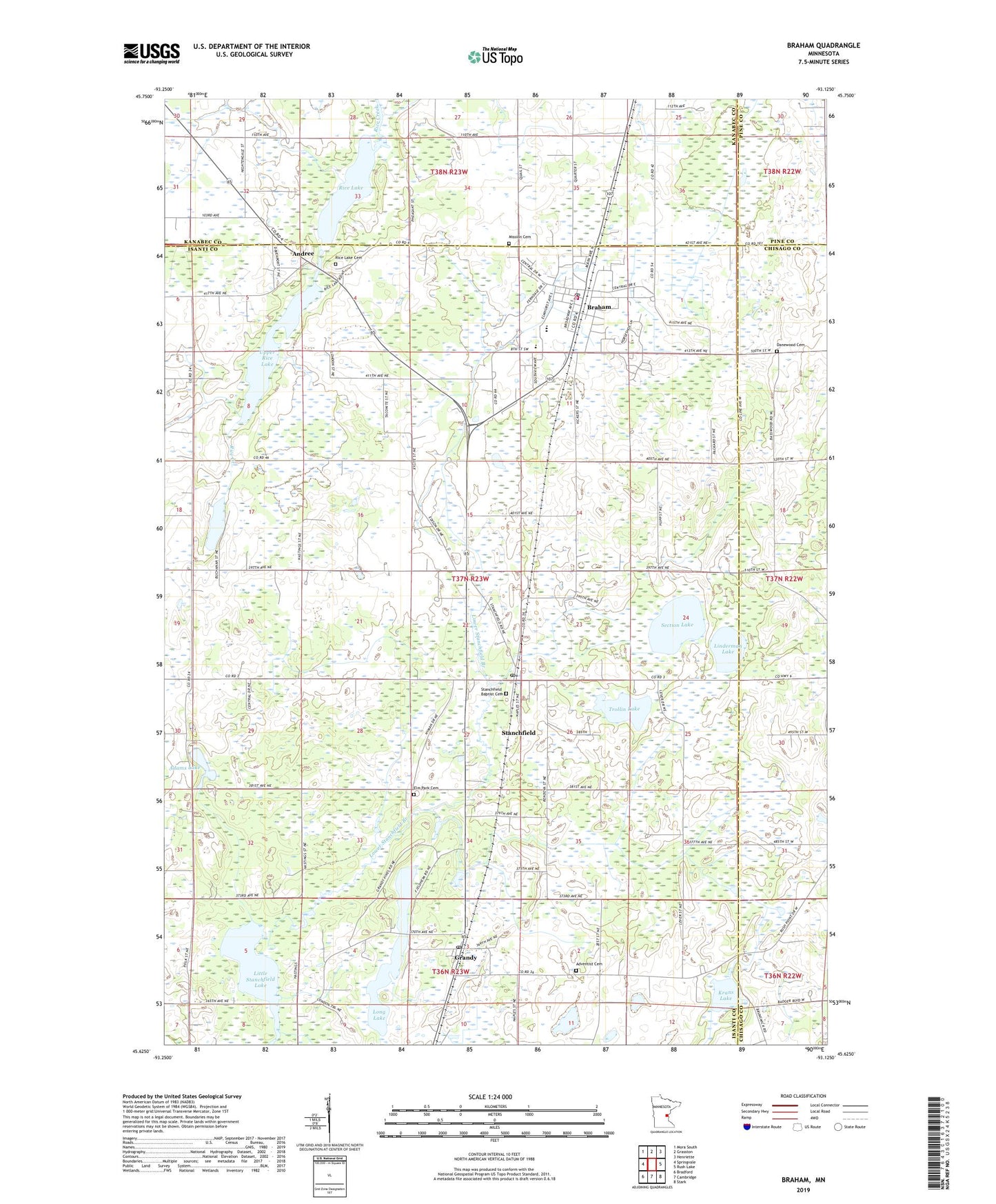
Braham Minnesota US Topo Map
Couldn't load pickup availability
2022 topographic map quadrangle Braham in the state of Minnesota. Scale: 1:24000. Based on the newly updated USGS 7.5' US Topo map series, this map is in the following counties: Isanti, Kanabec, Chisago, Pine. The map contains contour data, water features, and other items you are used to seeing on USGS maps, but also has updated roads and other features. This is the next generation of topographic maps. Printed on high-quality waterproof paper with UV fade-resistant inks.
Quads adjacent to this one:
West: Springvale
Northwest: Mora South
North: Grasston
Northeast: Henriette
East: Rush Lake
Southeast: Stark
South: Cambridge
Southwest: Bradford
This map covers the same area as the classic USGS quad with code o45093f2.
Contains the following named places: Adams Lake, Adventist Cemetery, Andree, Andree Post Office, Braham, Braham City Hall, Braham Evangelical Covenant Church, Braham Evangelical Lutheran Church, Braham Mobile Home Park, Braham Police Department, Braham Post Office, Braham Volunteer Fire Department, City of Braham, Danewood Cemetery, Elm Park Cemetery, Freedom Park, Grandy, Grandy Church, Grandy Golf Course, Grandy Pines Golf Course, Grandy Post Office, Grandy School, Hidden Park, Krans Lake, Linderman Lake, Little Stanchfield Lake, Long Lake, Lower Stanchfield Branch, Mission Cemetery, Purple Hawk Golf Course, Rice Creek State Wildlife Management Area, Rice Lake, Rice Lake Cemetery, Saint Peter and Paul Catholic Church, Saint Stephen's Lutheran Church, Section Lake, Seventeen Lake, Southview School, Stanchfield, Stanchfield Baptist Cemetery, Stanchfield Baptist Church, Stanchfield Census Designated Place, Stanchfield Corner, Stanchfield Post Office, Township of Stanchfield, Trollin Lake, Upper Rice Lake, Westview High School, ZIP Codes: 55006, 55029, 55080