MyTopo
Isanti Minnesota US Topo Map
Couldn't load pickup availability
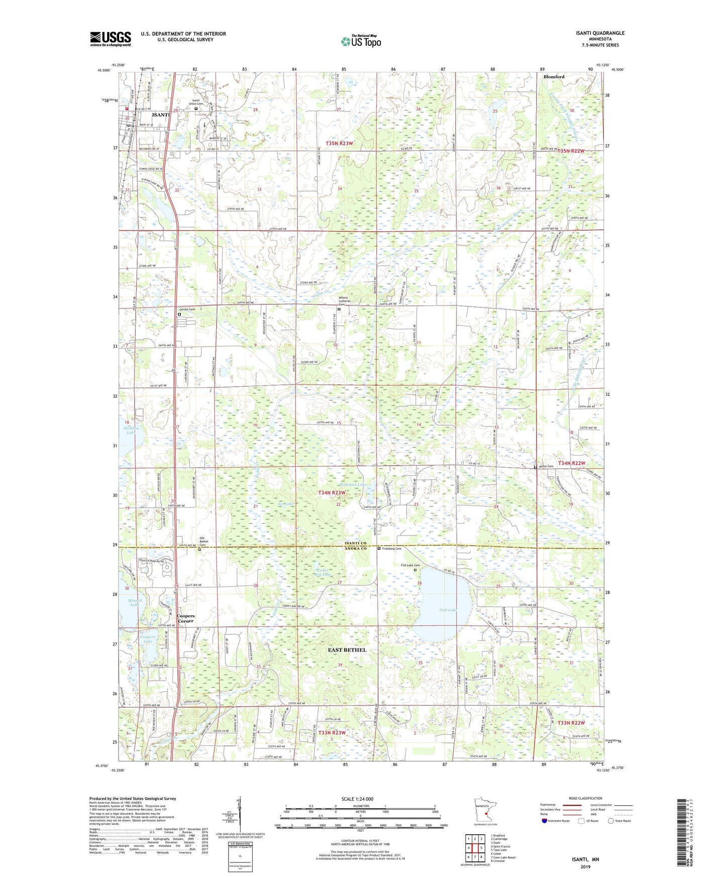
2022 topographic map quadrangle Isanti in the state of Minnesota. Scale: 1:24000. Based on the newly updated USGS 7.5' US Topo map series, this map is in the following counties: Isanti, Anoka. The map contains contour data, water features, and other items you are used to seeing on USGS maps, but also has updated roads and other features. This is the next generation of topographic maps. Printed on high-quality waterproof paper with UV fade-resistant inks.
Quads adjacent to this one:
West: Saint Francis
Northwest: Bradford
North: Cambridge
Northeast: Stark
East: Typo Lake
Southeast: Linwood
South: Coon Lake Beach
Southwest: Cedar
This map covers the same area as the classic USGS quad with code o45093d2.
Contains the following named places: Aetna Cemetery, Athens Lutheran Cemetery, Athens State Wildlife Management Area, Beckman Lake, Bible Baptist Church, Castle Towers Mobile Home Park, Cedar Bog Lake, Cedar Creek Natural History Area, City of Isanti, Coopers Corner, Coopers Lake, County Ditch Number Thirteen, County Ditch Number Twenty, Elim Baptist Church, Faith Lutheran Church, Fish Lake, Fish Lake Cemetery, Fridsborg Cemetery, Gerdin Cemetery, Ice Lake, Isanti, Isanti City Hall, Isanti Estates, Isanti Fire District Station 1, Isanti Police Department, Isanti Post Office, Isanti Union Cemetery, John Anderson Memorial Park, Laurence Collin Township Park, Minard Lake, Old Bethel Cemetery, Oxford Church, Saint Andrew Lutheran Church, Saint Johns Church, Township of Athens, Unity Park, Veterans of Foreign Wars Park, ZIP Code: 55005