MyTopo
Brewster Minnesota US Topo Map
Couldn't load pickup availability
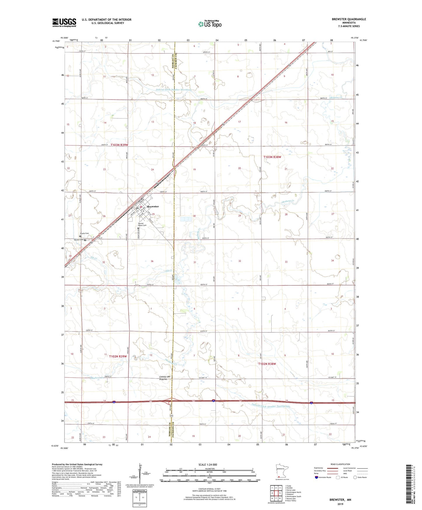
2022 topographic map quadrangle Brewster in the state of Minnesota. Scale: 1:24000. Based on the newly updated USGS 7.5' US Topo map series, this map is in the following counties: Jackson, Nobles. The map contains contour data, water features, and other items you are used to seeing on USGS maps, but also has updated roads and other features. This is the next generation of topographic maps. Printed on high-quality waterproof paper with UV fade-resistant inks.
Quads adjacent to this one:
West: Worthington North
Northwest: Fulda
North: Dundee
Northeast: Heron Lake
East: Okabena
Southeast: Sioux Valley
South: Round Lake
Southwest: Worthington South
This map covers the same area as the classic USGS quad with code o43095f4.
Contains the following named places: Brewster, Brewster City Hall, Brewster City Park, Brewster Fire and Rescue Department, Brewster Post Office, Brewster Public School, City of Brewster, Elk Creek, Hersey Cemetery, Judicial Ditch Number Eightyfive, Judicial Ditch Number Seventysix, Sacred Heart Cemetery, Sacred Heart Church, Township of Alba, Township of Ewington, Trinity Cemetery, Trinity Lutheran Church, ZIP Code: 56119