MyTopo
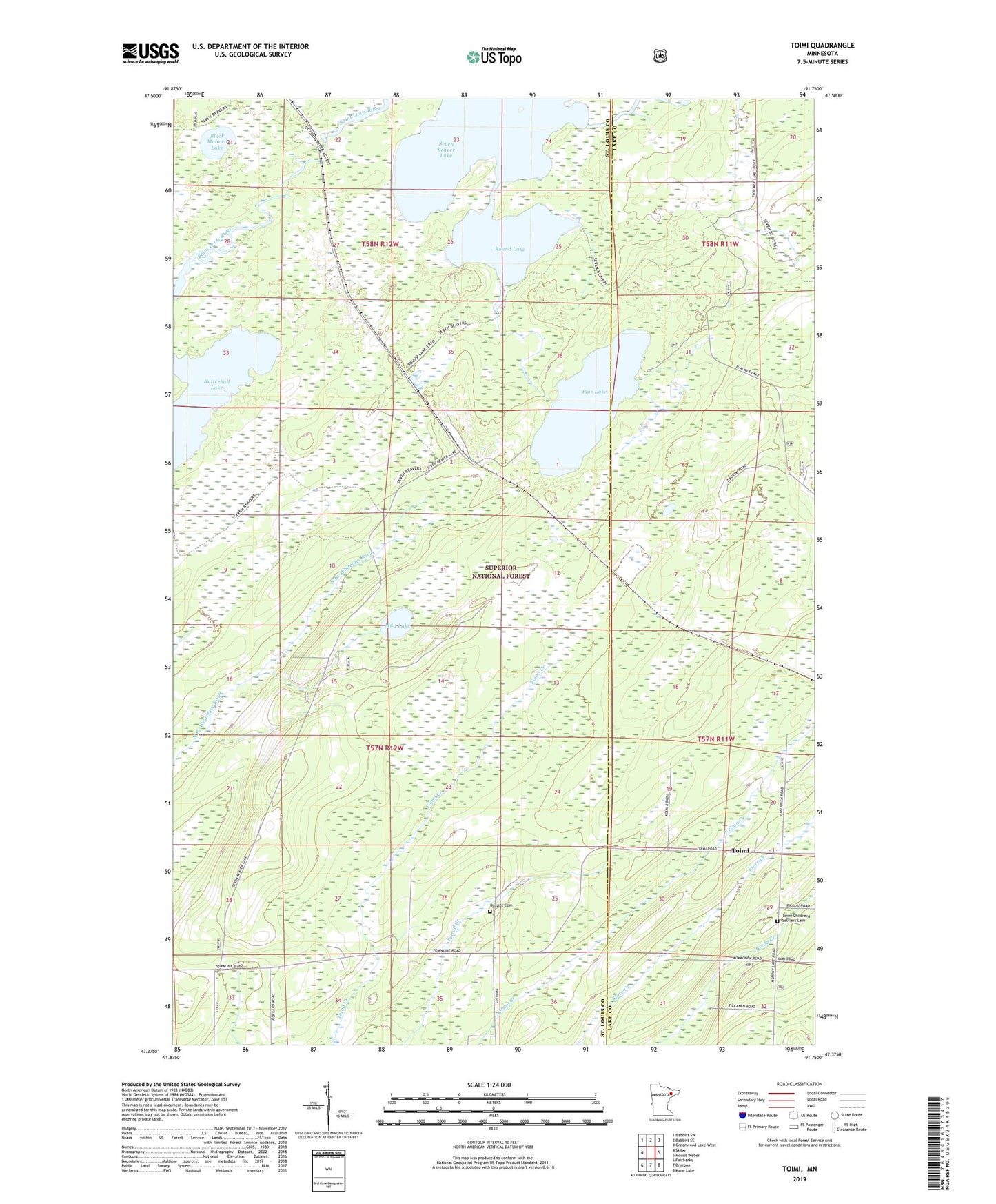
Toimi Minnesota US Topo Map
Couldn't load pickup availability
Also explore the Toimi Forest Service Topo of this same quad for updated USFS data
2022 topographic map quadrangle Toimi in the state of Minnesota. Scale: 1:24000. Based on the newly updated USGS 7.5' US Topo map series, this map is in the following counties: St. Louis, Lake. The map contains contour data, water features, and other items you are used to seeing on USGS maps, but also has updated roads and other features. This is the next generation of topographic maps. Printed on high-quality waterproof paper with UV fade-resistant inks.
Quads adjacent to this one:
West: Skibo
Northwest: Babbitt SW
North: Babbitt SE
Northeast: Greenwood Lake West
East: Mount Weber
Southeast: Kane Lake
South: Brimson
Southwest: Fairbanks
This map covers the same area as the classic USGS quad with code o47091d7.
Contains the following named places: Bassett, Bassett Cemetery, Bassett Church, Bassett School, Black Mallard Lake, Butterball Lake, East River, Mud Lake, Pine Lake, Round Lake, Seven Beaver Lake, Toimi, Toimi Childrens Settlers Cemetery, Toimi Post Office