MyTopo
Browerville Minnesota US Topo Map
Couldn't load pickup availability
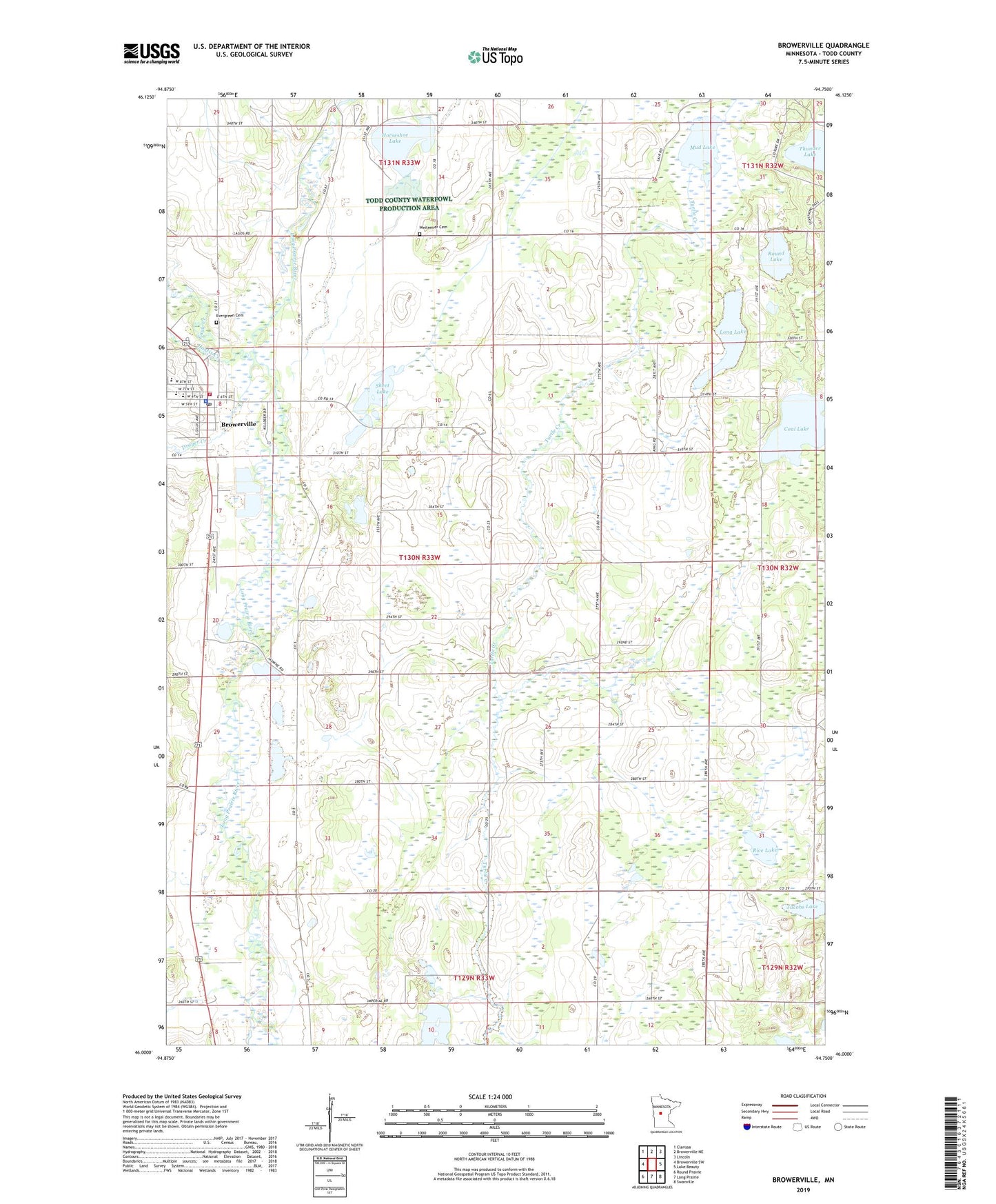
2019 topographic map quadrangle Browerville in the state of Minnesota. Scale: 1:24000. Based on the newly updated USGS 7.5' US Topo map series, this map is in the following counties: Todd. The map contains contour data, water features, and other items you are used to seeing on USGS maps, but also has updated roads and other features. This is the next generation of topographic maps. Printed on high-quality waterproof paper with UV fade-resistant inks.
Quads adjacent to this one:
West: Browerville SW
Northwest: Clarissa
North: Browerville NE
Northeast: Lincoln
East: Lake Beauty
Southeast: Swanville
South: Long Prairie
Southwest: Round Prairie
Contains the following named places: Browerville, Browerville Ambulance, Browerville City Hall, Browerville Fire Department, Browerville High School, Browerville Police Department, Browerville Post Office, Christ the King Church, Christ the King School, City of Browerville, Coal Lake, Drayer Creek, Eagle Creek, Evergreen Cemetery, Harris Creek, Horseshoe Lake, Jacobs Lake, KXDL-FM (Browerville), Lakewood Clinic, Long Lake, Meyer Lake, Mud Lake, Rice Lake, Round Lake, School Number 2267, School Number 2285, School Number 2327, School Number 2362, Sheet Lake, Sheets Lake State Wildlife Management Area, Township of Hartford, Turtle Creek State Wildlife Management Area, Weitemier Cemetery, Zion Lutheran Church