MyTopo
Browerville SW Minnesota US Topo Map
Couldn't load pickup availability
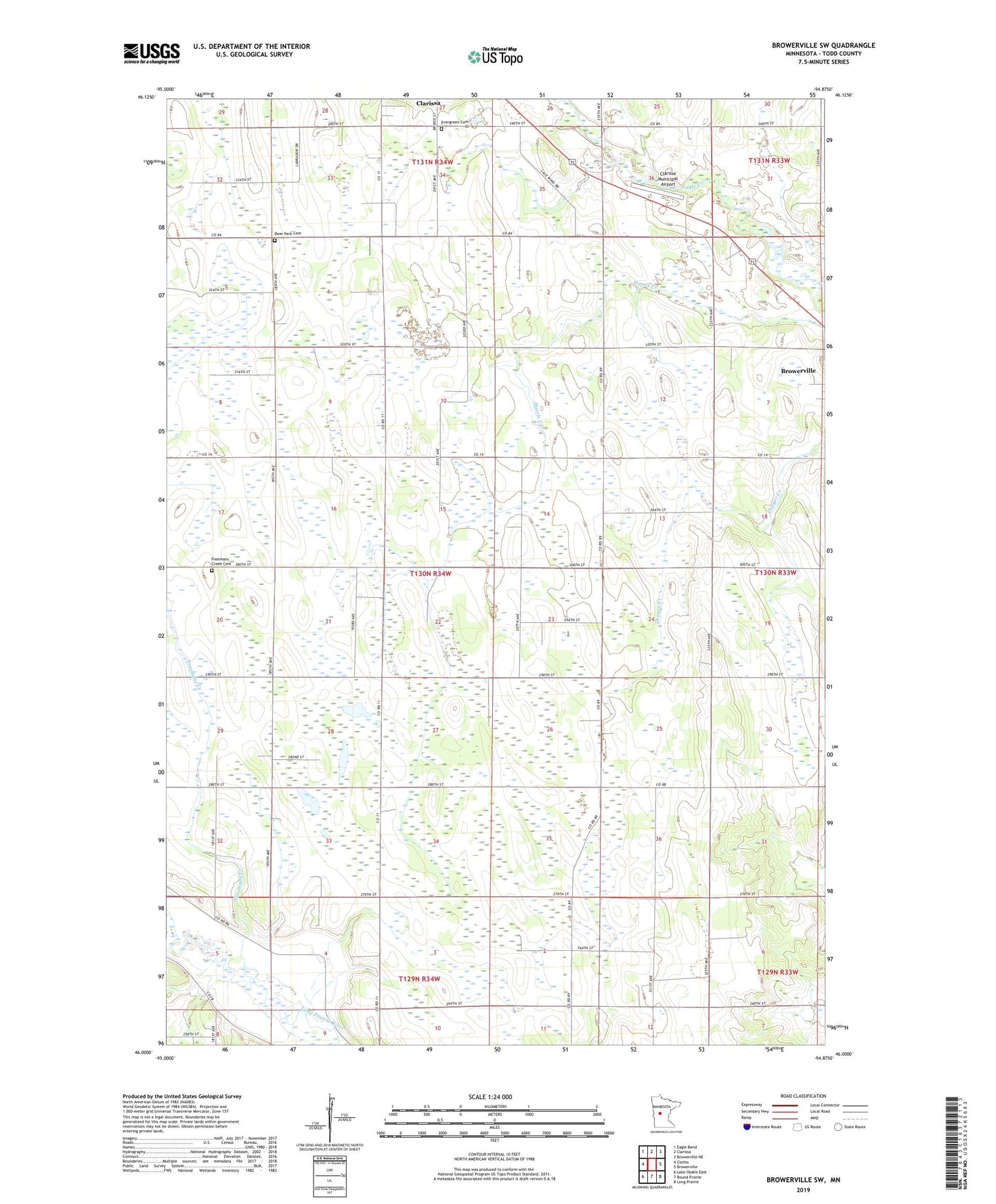
2022 topographic map quadrangle Browerville SW in the state of Minnesota. Scale: 1:24000. Based on the newly updated USGS 7.5' US Topo map series, this map is in the following counties: Todd. The map contains contour data, water features, and other items you are used to seeing on USGS maps, but also has updated roads and other features. This is the next generation of topographic maps. Printed on high-quality waterproof paper with UV fade-resistant inks.
Quads adjacent to this one:
West: Clotho
Northwest: Eagle Bend
North: Clarissa
Northeast: Browerville NE
East: Browerville
Southeast: Long Prairie
South: Round Prairie
Southwest: Lake Osakis East
This map covers the same area as the classic USGS quad with code o46094a8.
Contains the following named places: Clarissa Municipal Airport, Deer Park Cemetery, Evergreen Cemetery, Freemans Creek, Freemans Creek Cemetery, Iona State Wildlife Management Area, School Number 2299, School Number 2321, Todd County, Township of Iona