MyTopo
Lincoln Minnesota US Topo Map
Couldn't load pickup availability
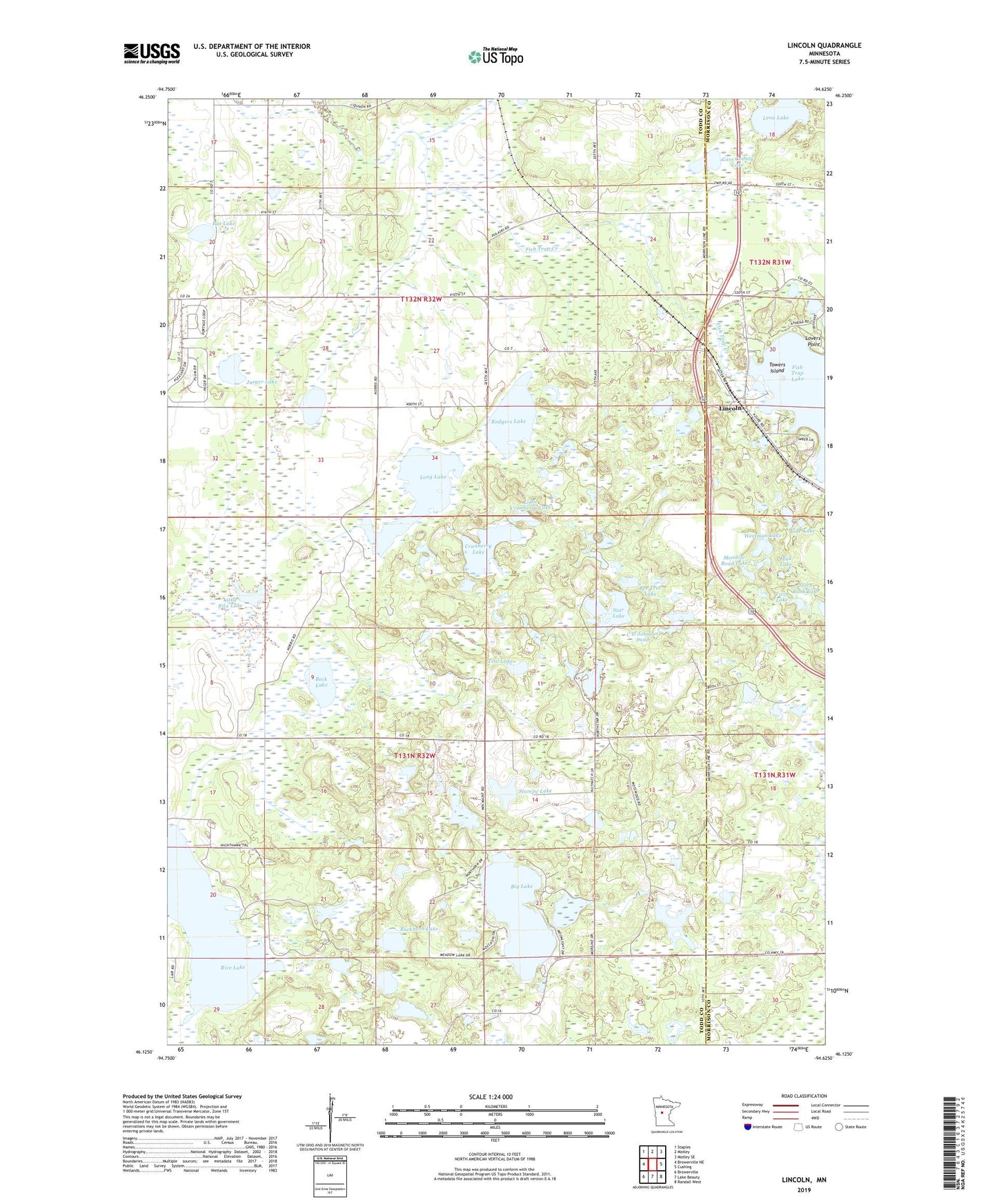
2022 topographic map quadrangle Lincoln in the state of Minnesota. Scale: 1:24000. Based on the newly updated USGS 7.5' US Topo map series, this map is in the following counties: Todd, Morrison. The map contains contour data, water features, and other items you are used to seeing on USGS maps, but also has updated roads and other features. This is the next generation of topographic maps. Printed on high-quality waterproof paper with UV fade-resistant inks.
Quads adjacent to this one:
West: Browerville NE
Northwest: Staples
North: Motley
Northeast: Motley SE
East: Cushing
Southeast: Randall West
South: Lake Beauty
Southwest: Browerville
This map covers the same area as the classic USGS quad with code o46094b6.
Contains the following named places: Beck Lake, Bee Tree Lake, Big Lake, Buckhorn Lake, C D Johnson Pond, C D Johnson Pond Dam, Cass County Lake, Cranberry Lake, D Stoerzinger Pond, D Stoerzinger Pond Dam, Fish Trap Lake, Jaeger Lake, L Kominek Pond, L Kominek Pond Dam, Lena Lake, Lincoln, Lincoln Church, Lincoln Evangelical Church, Lincoln Post Office, Line Lake, Little Cranberry Lake, Little Fish Trap Lake, Little Rice Lake, Long Lake, Lovers Point, Meadow Road Lake, Mud Lake, Rat Lake, Rice Lake, Rodgers Lake, School Number 106, School Number 111, School Number 137, School Number 159, School Number 20, School Number 761, Star Lake, Steep Bank Lake, Stumpy Lake, Teal Lake, Towers Island, Township of Fawn Lake, Township of Turtle Creek, Twin Lake, Westman Lake