MyTopo
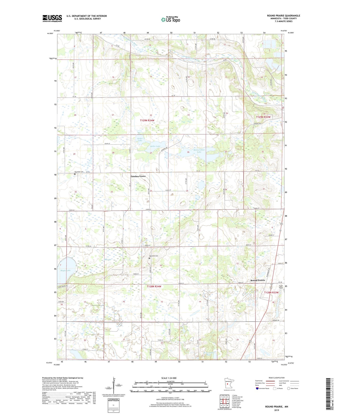
Round Prairie Minnesota US Topo Map
Couldn't load pickup availability
2022 topographic map quadrangle Round Prairie in the state of Minnesota. Scale: 1:24000. Based on the newly updated USGS 7.5' US Topo map series, this map is in the following counties: Todd. The map contains contour data, water features, and other items you are used to seeing on USGS maps, but also has updated roads and other features. This is the next generation of topographic maps. Printed on high-quality waterproof paper with UV fade-resistant inks.
Quads adjacent to this one:
West: Lake Osakis East
Northwest: Clotho
North: Browerville SW
Northeast: Browerville
East: Long Prairie
Southeast: Ward Springs
South: Sauk Lake
Southwest: West Union
This map covers the same area as the classic USGS quad with code o45094h8.
Contains the following named places: Gutches Grove, H Groschel Pond, Keller Lake, Kootenai Christian Mennonite Church, McCarrahan Lake, Mud Lake, Reynolds Baptist Cemetery, Reynolds Cemetery, Reynolds Church, Round Prairie, Round Prairie Community Church, Round Prairie Post Office, Saint John Vianney Church, School Number 2283, Township of Little Sauk, Township of Reynolds