MyTopo
Brownsdale Minnesota US Topo Map
Couldn't load pickup availability
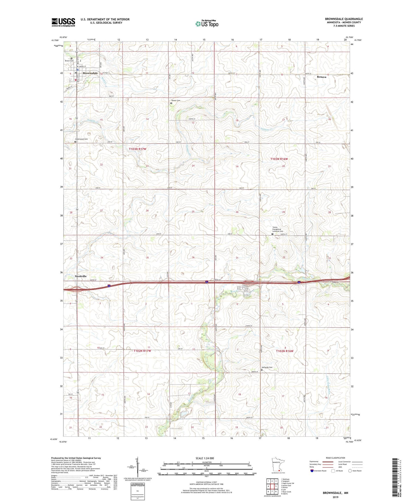
2019 topographic map quadrangle Brownsdale in the state of Minnesota. Scale: 1:24000. Based on the newly updated USGS 7.5' US Topo map series, this map is in the following counties: Mower. The map contains contour data, water features, and other items you are used to seeing on USGS maps, but also has updated roads and other features. This is the next generation of topographic maps. Printed on high-quality waterproof paper with UV fade-resistant inks.
Quads adjacent to this one:
West: Austin East
Northwest: Waltham
North: Sargeant
Northeast: High Forest SW
East: Dexter
Southeast: Adams
South: Rose Creek
Southwest: Lyle
Contains the following named places: Beaver Trails Campground, Brown Cemetery, Brownsdale, Brownsdale Elementary School, Brownsdale Police Department, Brownsdale Post Office, Brownsdale Public Library, Brownsdale Volunteer Fire Department, City of Brownsdale, First Baptist Church, Greenwood Cemetery, Hoflanda Cemetery, Hoflanda Church, Maple Leaf School, Monitor School, Mower County, Our Saviour's Lutheran Church, Renova, Renova Post Office, Schwerin Creek, Sunnyside School, Tanner Cemetery, Tanner School, Township of Dexter, Township of Marshall, Township of Red Rock, Township of Windom, Trinity Evangelical Church, Trinity Evangelical Lutheran Cemetery, Vista Village Mobile Home Park, ZIP Code: 55918