MyTopo
Dexter Minnesota US Topo Map
Couldn't load pickup availability
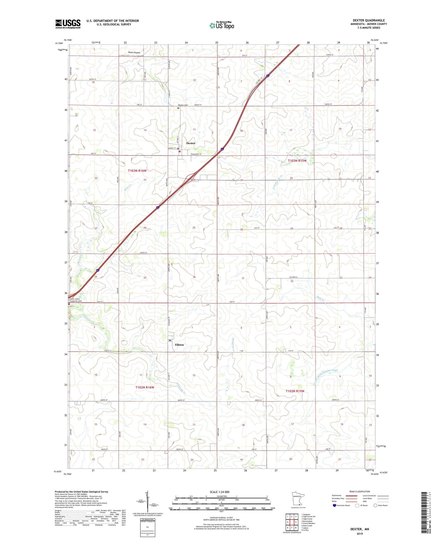
2022 topographic map quadrangle Dexter in the state of Minnesota. Scale: 1:24000. Based on the newly updated USGS 7.5' US Topo map series, this map is in the following counties: Mower. The map contains contour data, water features, and other items you are used to seeing on USGS maps, but also has updated roads and other features. This is the next generation of topographic maps. Printed on high-quality waterproof paper with UV fade-resistant inks.
Quads adjacent to this one:
West: Brownsdale
Northwest: Sargeant
North: High Forest SW
Northeast: High Forest
East: Grand Meadow
Southeast: Le Roy
South: Adams
Southwest: Rose Creek
This map covers the same area as the classic USGS quad with code o43092f6.
Contains the following named places: City of Dexter, City of Elkton, County Ditch Number Eight, Dexter, Dexter Cemetery, Dexter Post Office, Dexter Volunteer Fire Department, Elkton, Elkton Post Office, Petes Airport, Pleasant Acres Mobile Home Park, Saint John Church, Saint John's Lutheran Cemetery, Township of Clayton, Township of Grand Meadow, ZIP Codes: 55926, 55933