MyTopo
Adams Minnesota US Topo Map
Couldn't load pickup availability
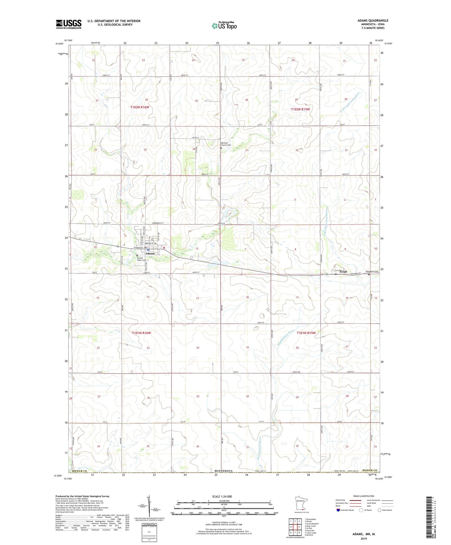
2022 topographic map quadrangle Adams in the state of Minnesota. Scale: 1:24000. Based on the newly updated USGS 7.5' US Topo map series, this map is in the following counties: Mower, Mitchell. The map contains contour data, water features, and other items you are used to seeing on USGS maps, but also has updated roads and other features. This is the next generation of topographic maps. Printed on high-quality waterproof paper with UV fade-resistant inks.
Quads adjacent to this one:
West: Rose Creek
Northwest: Brownsdale
North: Dexter
Northeast: Grand Meadow
East: Le Roy
Southeast: McIntire
South: Little Cedar
Southwest: Stacyville
This map covers the same area as the classic USGS quad with code o43092e6.
Contains the following named places: Adams, Adams Area Ambulance Service, Adams Clinic, Adams Health Care Center, Adams Police Department, Adams Post Office, Adams Volunteer Fire Department, Cedar River Country Club, City of Adams, City of Taopi, East Willow Creek Dam, Gilgenbachs Airport, Judicial Ditch Number Six, Little Cedar Lutheran Church, Marshall Church Cemetery, Marshall Lutheran Church, Sacred Heart Cemetery, Sacred Heart Church, Sacred Heart School, Southland High School, Taopi, Taopi Post Office, Township of Adams, Township of Lodi, Woodlawn Cemetery, ZIP Codes: 55909, 55977