MyTopo
Butler Minnesota US Topo Map
Couldn't load pickup availability
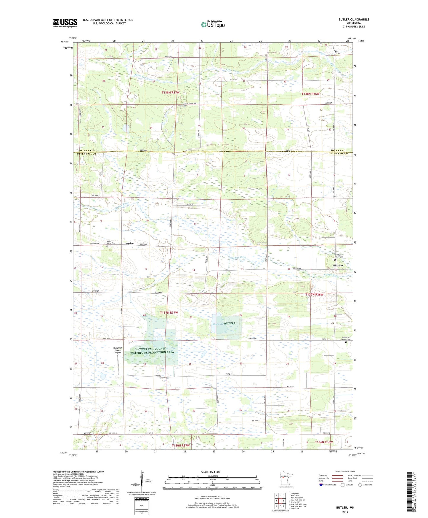
2022 topographic map quadrangle Butler in the state of Minnesota. Scale: 1:24000. Based on the newly updated USGS 7.5' US Topo map series, this map is in the following counties: Otter Tail, Becker. The map contains contour data, water features, and other items you are used to seeing on USGS maps, but also has updated roads and other features. This is the next generation of topographic maps. Printed on high-quality waterproof paper with UV fade-resistant inks.
Quads adjacent to this one:
West: New York Mills NW
Northwest: Evergreen
North: Wolf Lake
Northeast: Park Rapids SW
East: Sebeka NW
Southeast: Sebeka SW
South: New York Mills East
Southwest: New York Mills West
This map covers the same area as the classic USGS quad with code o46095f3.
Contains the following named places: Butler, Butler Post Office, Hillview, Hillview Post Office, Hintzman Private Airport, Holy Cross Cemetery, Holy Cross Church, Mud Lake, Paddock - Bethel Cemetery, Red Eye Valley Cemetery, Township of Butler