MyTopo
Caribou NE Minnesota US Topo Map
Couldn't load pickup availability
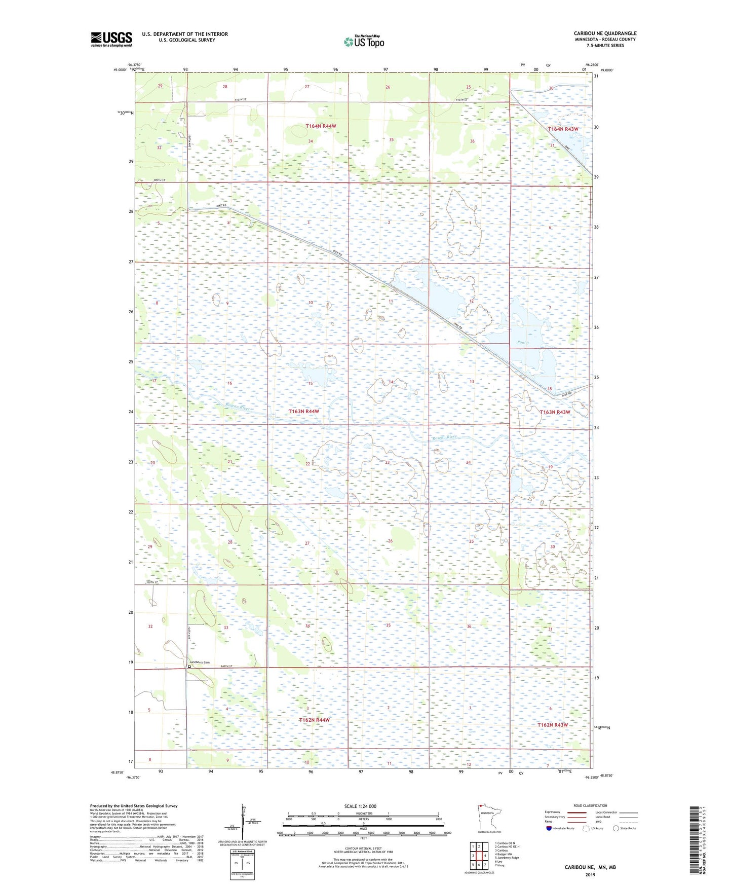
2022 topographic map quadrangle Caribou NE in the state of Minnesota. Scale: 1:24000. Based on the newly updated USGS 7.5' US Topo map series, this map is in the following counties: Roseau. The map contains contour data, water features, and other items you are used to seeing on USGS maps, but also has updated roads and other features. This is the next generation of topographic maps. Printed on high-quality waterproof paper with UV fade-resistant inks.
Quads adjacent to this one:
West: Caribou
Northwest: Caribou OE N
North: Caribou NE OE N
East: Badger NW
Southeast: Haug
South: Leo
Southwest: Juneberry Ridge
This map covers the same area as the classic USGS quad with code o48096h3.
Contains the following named places: Johnson School, Juneberry Cemetery, Noacres, Noracres Post Office, Oak Point Post Office, Pool 3, Pool Number Trhee, Roseau River Wildlife Management Area Pool3 Dam, Township of Blooming Valley, Unorganized Territory of Northwest Roseau