MyTopo
Cerro Gordo Minnesota US Topo Map
Couldn't load pickup availability
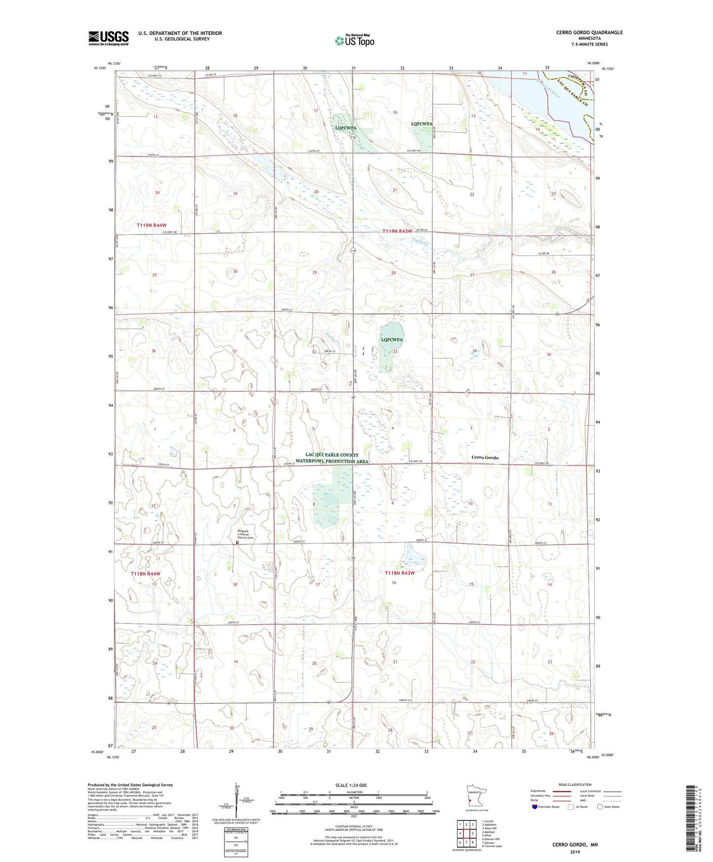
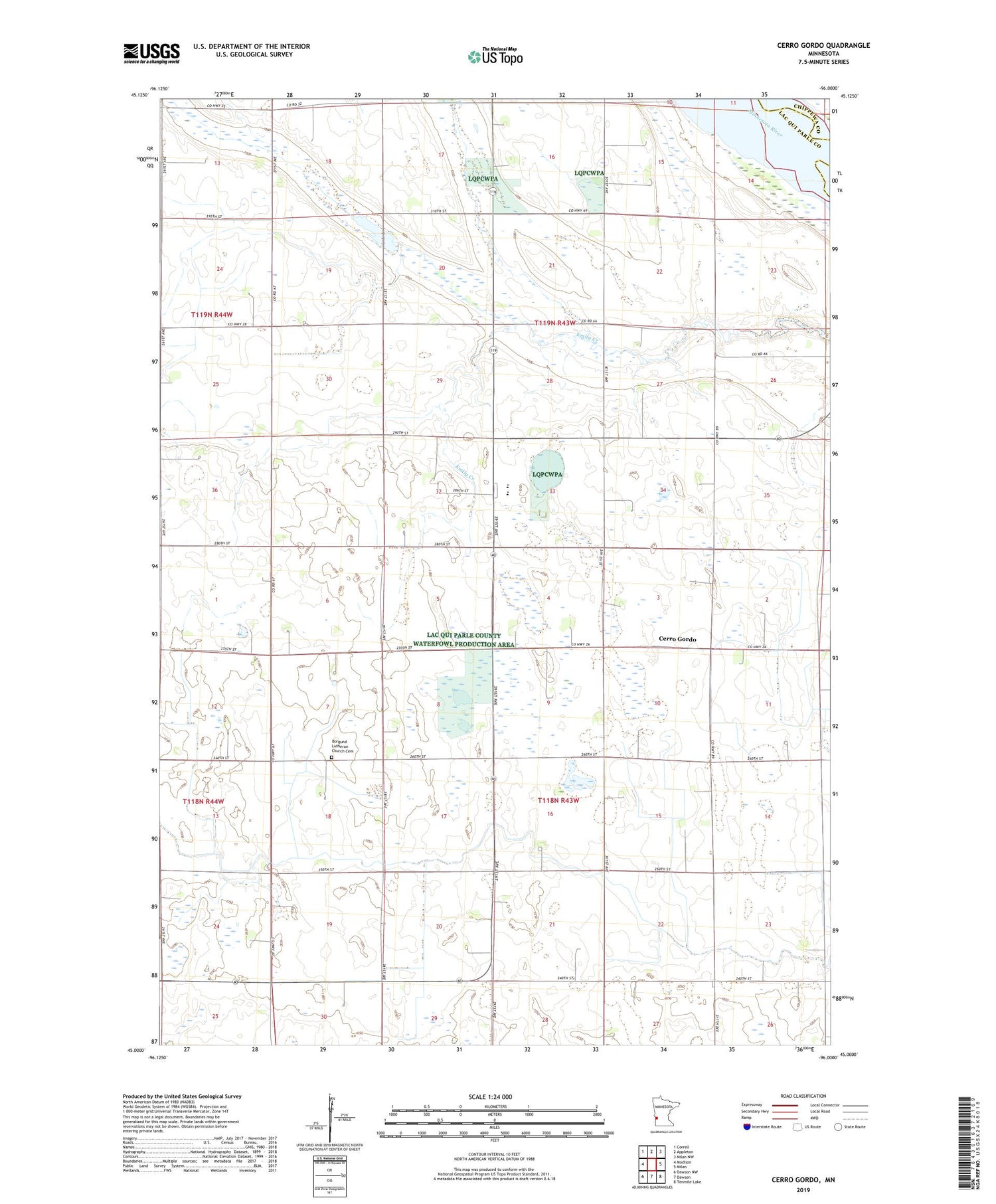
2019 topographic map quadrangle Cerro Gordo in the state of Minnesota. Scale: 1:24000. Based on the newly updated USGS 7.5' US Topo map series, this map is in the following counties: Lac qui Parle, Chippewa. The map contains contour data, water features, and other items you are used to seeing on USGS maps, but also has updated roads and other features. This is the next generation of topographic maps. Printed on high-quality waterproof paper with UV fade-resistant inks.
Quads adjacent to this one:
West: Madison
Northwest: Correll
North: Appleton
Northeast: Milan NW
East: Milan
Southeast: Tenmile Lake
South: Dawson
Southwest: Dawson NW
Contains the following named places: Borgund Church, Borgund Lutheran Church Cemetery, Cerro Gordo, Cerrogordo Post Office, Hantho School, School Number 841, School Number 842, School Number 866, School Number 871, Township of Cerro Gordo, Township of Hantho