MyTopo
Dawson Minnesota US Topo Map
Couldn't load pickup availability
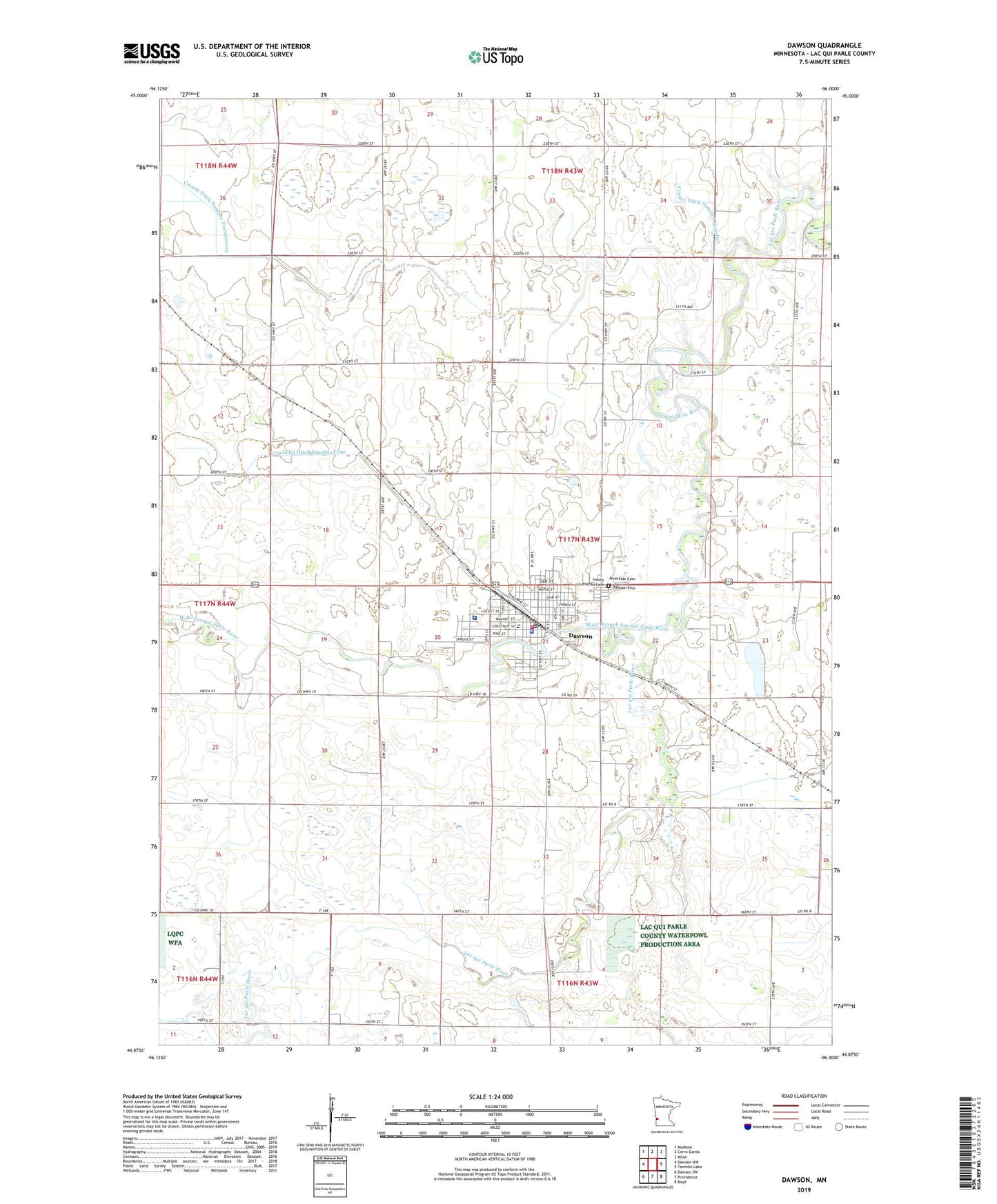
2022 topographic map quadrangle Dawson in the state of Minnesota. Scale: 1:24000. Based on the newly updated USGS 7.5' US Topo map series, this map is in the following counties: Lac qui Parle. The map contains contour data, water features, and other items you are used to seeing on USGS maps, but also has updated roads and other features. This is the next generation of topographic maps. Printed on high-quality waterproof paper with UV fade-resistant inks.
Quads adjacent to this one:
West: Dawson NW
Northwest: Madison
North: Cerro Gordo
Northeast: Milan
East: Tenmile Lake
Southeast: Boyd
South: Providence
Southwest: Dawson SW
This map covers the same area as the classic USGS quad with code o44096h1.
Contains the following named places: American Legion Golf Course, City of Dawson, Community Bible Church, County Ditch Number Ninetyfive, County Ditch Number Twentyseven, Dawson, Dawson Boyd High School, Dawson Cemetery, Dawson Clinic, Dawson Covenant Church, Dawson Elementary School, Dawson Fire Department, Dawson Municipal Airport, Dawson Police Department, Dawson Post Office, Dawson Public Library, Grace Lutheran Church, Johnson Memorial Health Services, Johnson Memorial Hospital, Judicial Ditch Number Four, Living Water Evangelical Lutheran Church, Presbyterian Church, Riverside Cemetery, Saint James Church, Township of Riverside, Trinity Lutheran Cemetery, West Branch Lac qui Parle River, ZIP Code: 56232