MyTopo
Clarissa Minnesota US Topo Map
Couldn't load pickup availability
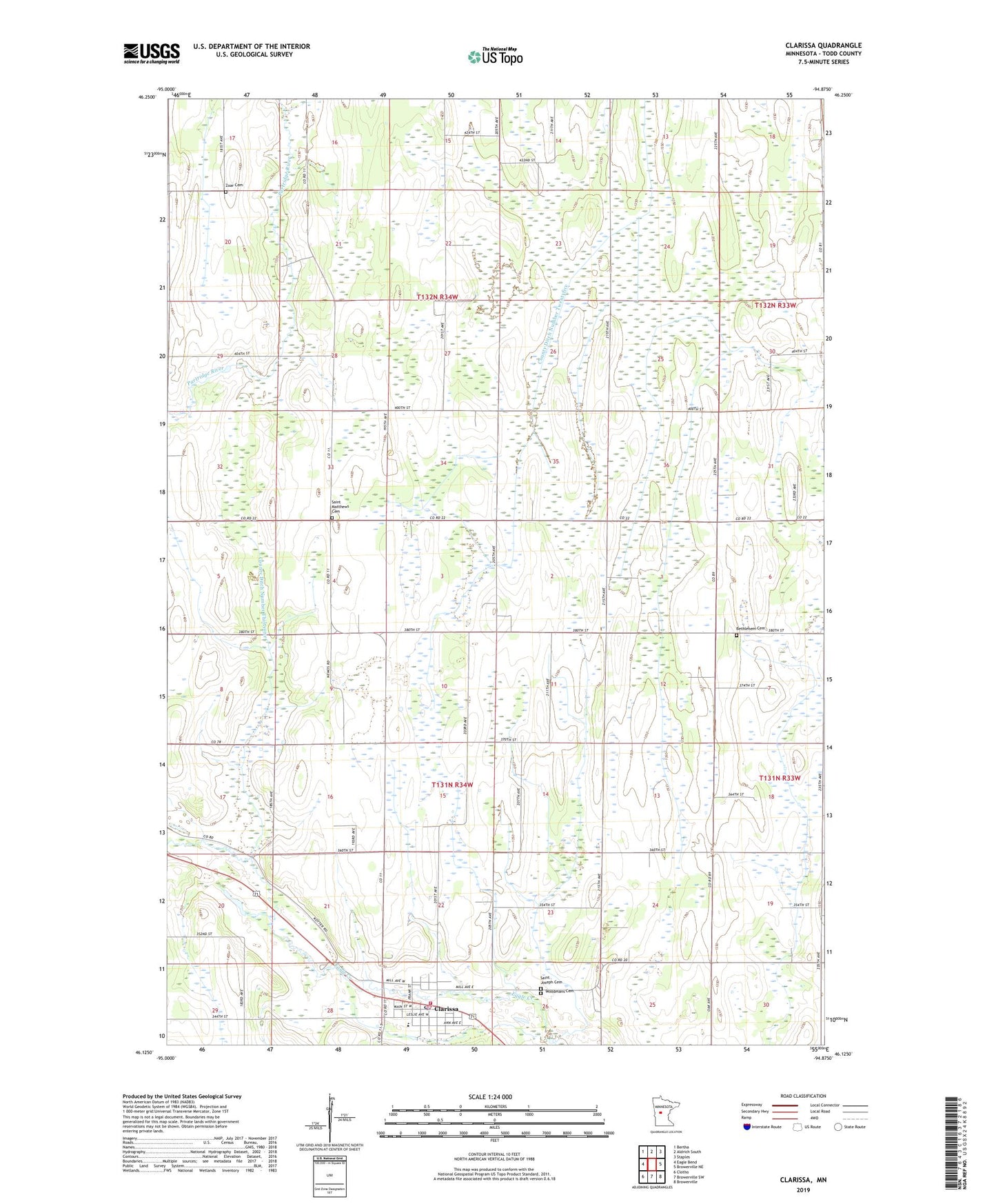
2019 topographic map quadrangle Clarissa in the state of Minnesota. Scale: 1:24000. Based on the newly updated USGS 7.5' US Topo map series, this map is in the following counties: Todd. The map contains contour data, water features, and other items you are used to seeing on USGS maps, but also has updated roads and other features. This is the next generation of topographic maps. Printed on high-quality waterproof paper with UV fade-resistant inks.
Quads adjacent to this one:
West: Eagle Bend
Northwest: Bertha
North: Aldrich South
Northeast: Staples
East: Browerville NE
Southeast: Browerville
South: Browerville SW
Southwest: Clotho
Contains the following named places: Bethlehem Cemetery, Bethlehem Church, Central Todd County Nursing Home, City of Clarissa, Clarissa, Clarissa City Hall, Clarissa Fire Department, Clarissa Medical Center, Clarissa Police Department, Clarissa Post Office, County Ditch Number Thirtyone, County Ditch Number Twentyfive, Eagle Valley Elementary School, Immanuel Lutheran Church, Saint Joseph Catholic Church, Saint Joseph Cemetery, Saint Matthew Lutheran Church, Saint Matthews Cemetery, Scandinavian Church, School Number 2282, School Number 2286, School Number 2365, Township of Eagle Valley, Township of Germania, United Methodist Church, Valley Our Saviors Church, Woodmans Cemetery, Zoar Cemetery, ZIP Code: 56440