MyTopo
Aldrich South Minnesota US Topo Map
Couldn't load pickup availability
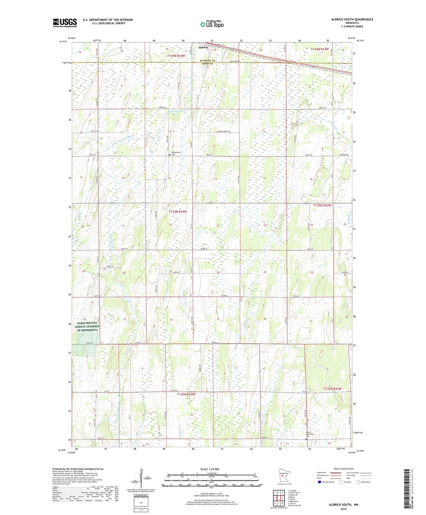
2022 topographic map quadrangle Aldrich South in the state of Minnesota. Scale: 1:24000. Based on the newly updated USGS 7.5' US Topo map series, this map is in the following counties: Todd, Wadena. The map contains contour data, water features, and other items you are used to seeing on USGS maps, but also has updated roads and other features. This is the next generation of topographic maps. Printed on high-quality waterproof paper with UV fade-resistant inks.
Quads adjacent to this one:
West: Bertha
Northwest: Verndale
North: Aldrich North
Northeast: Staples NE
East: Staples
Southeast: Browerville NE
South: Clarissa
Southwest: Eagle Bend
This map covers the same area as the classic USGS quad with code o46094c8.
Contains the following named places: Balsamlund Cemetery, Balsamlund Church, City of Aldrich, Egly Creek, Little Partridge River, Maple Leaf School, Moran - Germania Cemetery, Moran-Germania Church, Pioneer School, Township of Bartlett, ZIP Code: 56434