MyTopo
Cleveland Minnesota US Topo Map
Couldn't load pickup availability
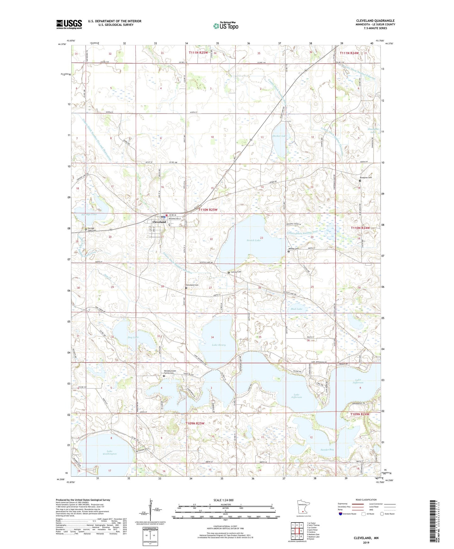
2019 topographic map quadrangle Cleveland in the state of Minnesota. Scale: 1:24000. Based on the newly updated USGS 7.5' US Topo map series, this map is in the following counties: Le Sueur. The map contains contour data, water features, and other items you are used to seeing on USGS maps, but also has updated roads and other features. This is the next generation of topographic maps. Printed on high-quality waterproof paper with UV fade-resistant inks.
Quads adjacent to this one:
West: Saint Peter
Northwest: Le Sueur
North: Saint Thomas
Northeast: Le Center
East: Cordova
Southeast: Elysian
South: Madison Lake
Southwest: Mankato East
Contains the following named places: Big Woods and Geldner Saw Mill Historical Marker, Bluegrass Cemetery, Calvary Cemetery, Church of Christ, Church of the Nativity, City of Cleveland, Cleveland, Cleveland Cemetery, Cleveland City Hall, Cleveland Fire and Rescue, Cleveland Police Department, Cleveland Post Office, Cleveland Public Library, Cleveland Public School, County Ditch Number Fiftyone, County Ditch Number Five and Thirtyseven, County Ditch Number Fortyseven, County Ditch Number Four, County Ditch Number Sixty, County Ditch Number Sixtyfive, County Ditch Number Thirtynine, Cox Apple Orchard, Decker Lake, Dog Lake, Krenik Swine Farms, Lake Henry, Lake Jefferson, Lake Washington, Meeker Cemetery, Mud Lake, Our Saviour's Lutheran Church, Savidge Lake, Savidge Lake Cemetery, Scotch Lake, Swedes Bay, Township of Cleveland, Township of Washington, Wendelschafer Family Cemetery, ZIP Code: 56017