MyTopo
Elysian Minnesota US Topo Map
Couldn't load pickup availability
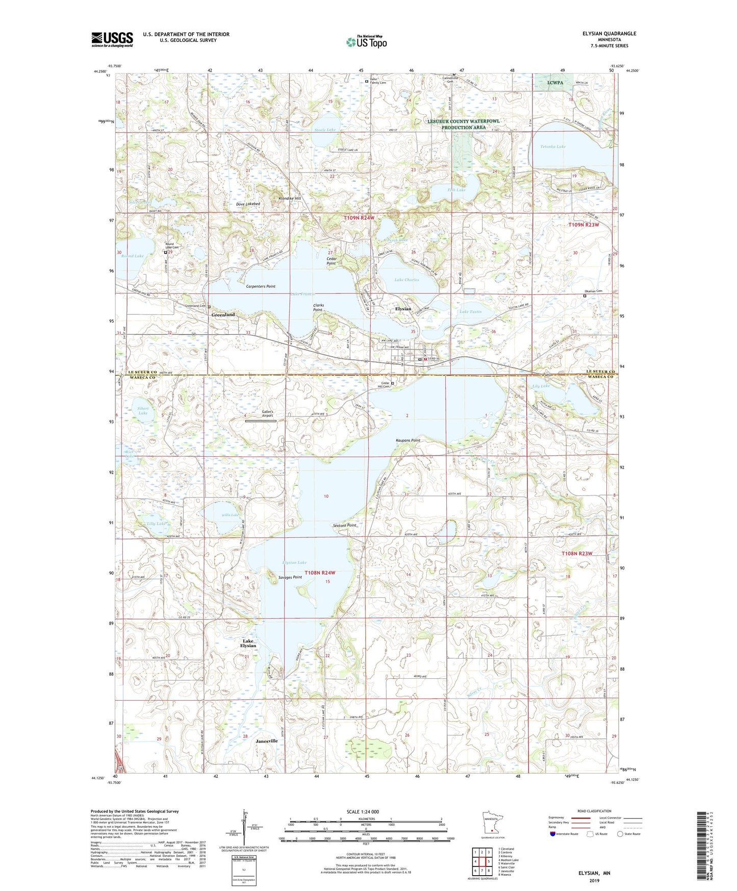
2022 topographic map quadrangle Elysian in the state of Minnesota. Scale: 1:24000. Based on the newly updated USGS 7.5' US Topo map series, this map is in the following counties: Waseca, Le Sueur. The map contains contour data, water features, and other items you are used to seeing on USGS maps, but also has updated roads and other features. This is the next generation of topographic maps. Printed on high-quality waterproof paper with UV fade-resistant inks.
Quads adjacent to this one:
West: Madison Lake
Northwest: Cleveland
North: Cordova
Northeast: Kilkenny
East: Waterville
Southeast: Waseca
South: Janesville
Southwest: Saint Clair
This map covers the same area as the classic USGS quad with code o44093b6.
Contains the following named places: Assembly of God Church, Bethlehem Lutheran Church, Cannonville Cemetery, Cannonville Church, Carpenters Point, Cedar Hill Cemetery, Cedar Point, City of Elysian, Clarks Point, County Ditch Number Fiftynine, County Ditch Number Nine, County Ditch Number One, Dehn Family Cemetery, Dove Lakebed, Elysian, Elysian Elementary School, Elysian Fire Department, Elysian Lake, Elysian Lake Dam, Elysian Post Office, Elysian Public Library, Fish Lake, Galler's Airport, Greenland, Greenland Cemetery, Greenland Post Office, Iosco Creek, Irish Mountain Orchard, Kaupans Point, Klondike Hill, Lake Charles, Lake Elysian, Lake Francis, Lake Tustin, Lakeview Lake, Lakeview Park, Le Sueur County Museum, Lilly Lake, Lily Lake, Okaman Cemetery, Perch Lake, Prairie Ridge Golf Course, Rice Lake, Round Lake, Round Lake Cemetery, Saint Andrew's Church, Savages Point, Sextons Point, Sibert Lake, Silver Lake, Steele Lake, Township of Elysian, Township of Janesville, Willis Lake, ZIP Code: 56028