MyTopo
Madison Lake Minnesota US Topo Map
Couldn't load pickup availability
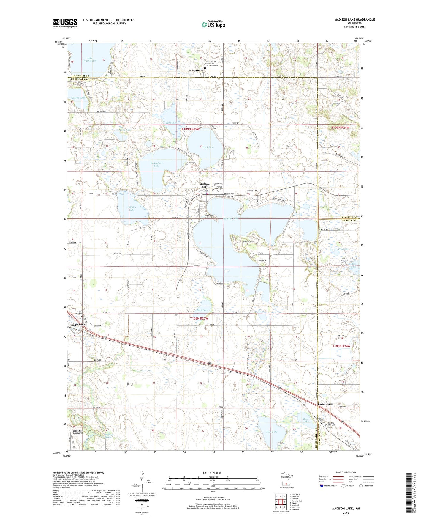
2022 topographic map quadrangle Madison Lake in the state of Minnesota. Scale: 1:24000. Based on the newly updated USGS 7.5' US Topo map series, this map is in the following counties: Blue Earth, Le Sueur, Waseca. The map contains contour data, water features, and other items you are used to seeing on USGS maps, but also has updated roads and other features. This is the next generation of topographic maps. Printed on high-quality waterproof paper with UV fade-resistant inks.
Quads adjacent to this one:
West: Mankato East
Northwest: Saint Peter
North: Cleveland
Northeast: Cordova
East: Elysian
Southeast: Janesville
South: Saint Clair
Southwest: Beauford
This map covers the same area as the classic USGS quad with code o44093b7.
Contains the following named places: Alice Lake, All Saints Academy, All Saints Catholic Church, Ballantyne Lake, Boat Landing Campground, Born Lake, Bray Park, Bray Park Campground, Calvary Cemetery, Church of the Immaculate Conception Cemetery, City of Madison Lake, County Ditch Number Twelve, Duck Lake, Eagle Lake Cemetery, Fish Lake, George Lake, Gilfillin Lake, Health Care Associates Center, Judicial Ditch Number Fifteen, Long Lake, Madison Lake, Madison Lake City Hall, Madison Lake Fire Department, Madison Lake Police Department, Madison Lake Post Office, Mankato Spring, Marysburg, Marysburg Post Office, Mud Lake, Pleasant Hill Manor, Point Pleasant Campground, Sakatah Singing Hills State Trail Parking, Smiths Mill, Smith's Mill Cemetery, Smiths Mill Post Office, Township of Jamestown, Township of Le Ray, Valley News County-Lake Washington Seaplane Base, ZIP Codes: 56024, 56063