MyTopo
Climax Minnesota US Topo Map
Couldn't load pickup availability
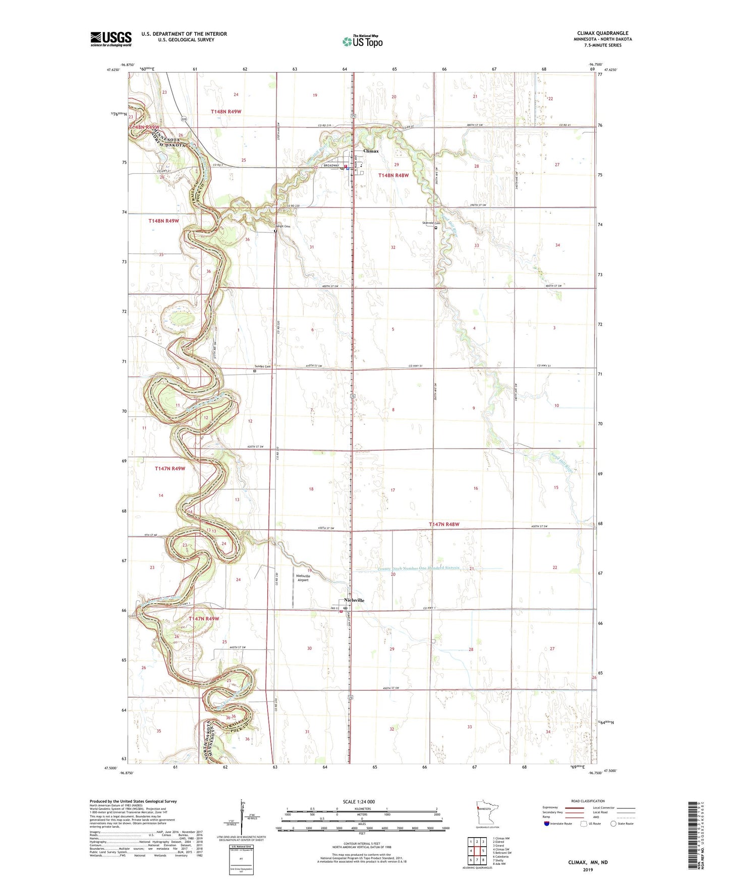
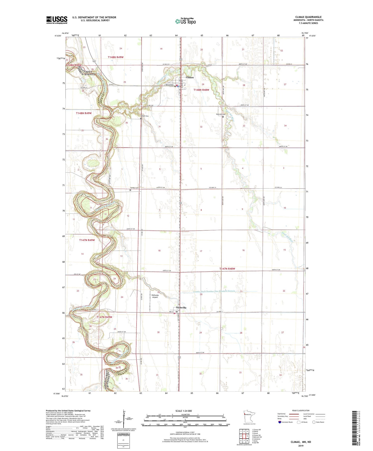
2019 topographic map quadrangle Climax in the state of Minnesota. Scale: 1:24000. Based on the newly updated USGS 7.5' US Topo map series, this map is in the following counties: Polk, Traill. The map contains contour data, water features, and other items you are used to seeing on USGS maps, but also has updated roads and other features. This is the next generation of topographic maps. Printed on high-quality waterproof paper with UV fade-resistant inks.
Quads adjacent to this one:
West: Climax SW
Northwest: Climax NW
North: Eldred
Northeast: Girard
East: Beltrami SW
Southeast: Ada NW
South: Shelly
Southwest: Caledonia
Contains the following named places: Bergit Cemetery, City of Climax, City of Nielsville, Climax, Climax Municipal Golf Course, Climax Police Department, Climax Post Office, Climax Volunteer Fire Department, County Ditch Number One Hundred Sixtysix, Living Water Assembly of God Church, Minnesota Noname Number 3 Dam, Nielsville, Nielsville Airport, Nielsville City Hall, Nielsville Dam, Nielsville Post Office, Nielsville Volunteer Fire Department, Saint Petri Lutheran Church, Sand Hill River, Skatvold Cemetery, Sundet Cemetery, Township of Hubbard, ZIP Code: 56568