
MyTopo
Clubhouse Lake Minnesota US Topo Map
Couldn't load pickup availability
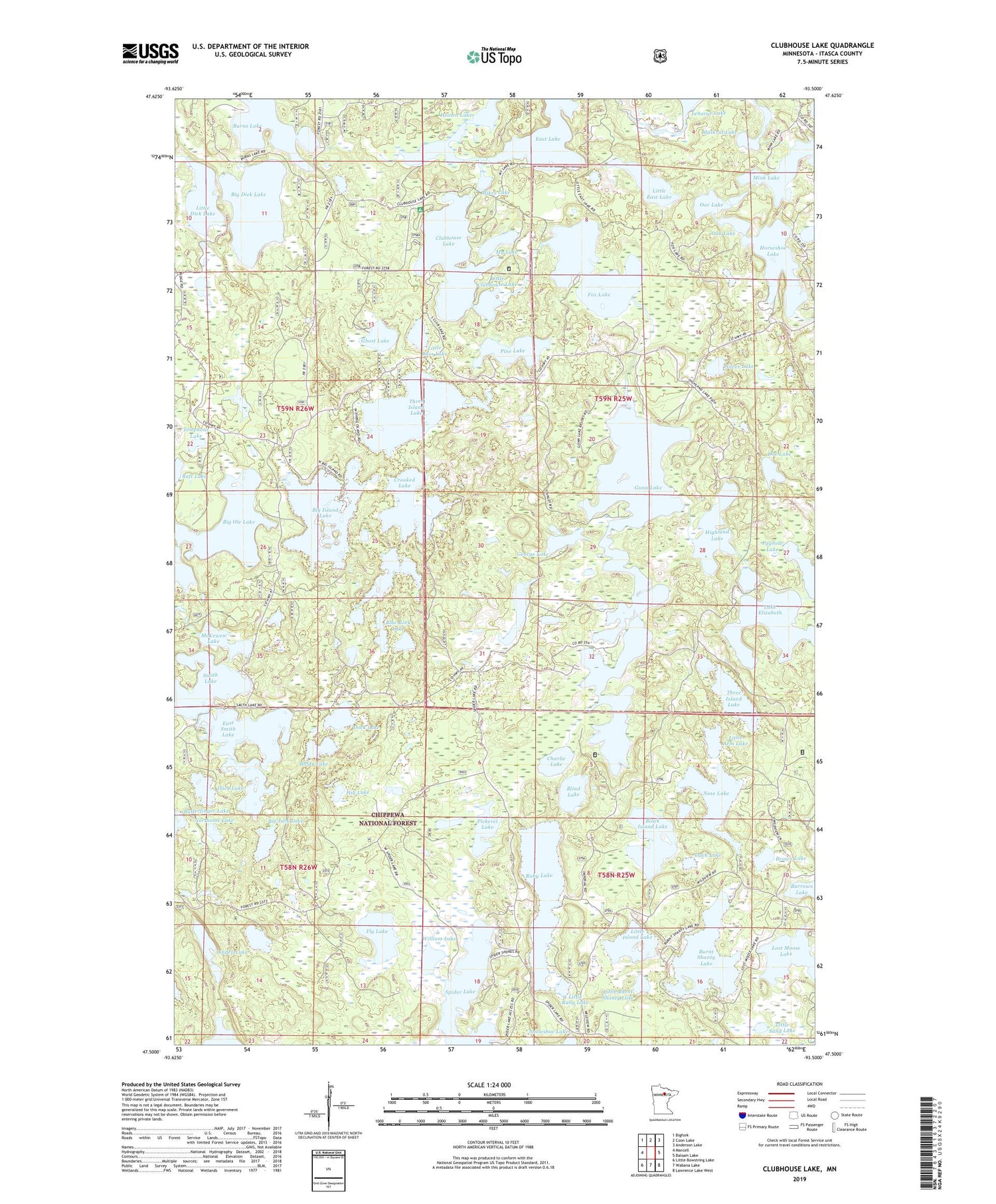
2019 topographic map quadrangle Clubhouse Lake in the state of Minnesota. Scale: 1:24000. Based on the newly updated USGS 7.5' US Topo map series, this map is in the following counties: Itasca. The map contains contour data, water features, and other items you are used to seeing on USGS maps, but also has updated roads and other features. This is the next generation of topographic maps. Printed on high-quality waterproof paper with UV fade-resistant inks.
Quads adjacent to this one:
West: Marcell
Northwest: Bigfork
North: Coon Lake
Northeast: Anderson Lake
East: Balsam Lake
Southeast: Lawrence Lake West
South: Wabana Lake
Southwest: Little Bowstring Lake
Contains the following named places: Allen Lake, Baldy Lake, Big Dick Lake, Big Island Lake, Big Jack Lake, Big Ole Lake, Black Island Lake, Blind Lake, Blue Rock Lake, Brown Lake, Burns Lake, Burns Lake Seaplane Base, Burnt Shanty Lake, Charlie Lake, Chickadee Lake, Clubhouse Lake, Clubhouse Lake Campground, Copenhagen Lake, Crooked Lake, Dock Lake, Doe Lake, Duck Lake, East Lake, East Smith Lake, Fishhook Lake, Fly Lake, Fox Lake, George Lake, Ghost Lake, Gunn Lake, Heinen Lake, Highland Lake, Hill Lake, Horseshoe Lake, Lake Elizabeth, Lebarge Lake, Linden Lake, Little Arm Lake, Little Bass Lake, Little Burnt Shanty Lake, Little Clubhouse Lake, Little Dick Lake, Little East Lake, Little Island Lake, Little McKewen Lake, Little Ole Lake, Little Ruby Lake, Little Sand Lake, Lost Moose Lake, McKewen Lake, Mikes Lake, Mink Lake, Muskrat Lake, My Lake, No Mans Lake, Northome Lake, Nose Lake, Oak Lake, Oar Lake, Pickerel Lake, Pine Lake, Pughole Lake, Raft Lake, Release Post Office, Ruby Lake, Silver Lake, Smith Lake, South Smith Lake, Telephone Lake, Three Island Lake, William Lake


