MyTopo
Crocodile Lake Minnesota US Topo Map
Couldn't load pickup availability
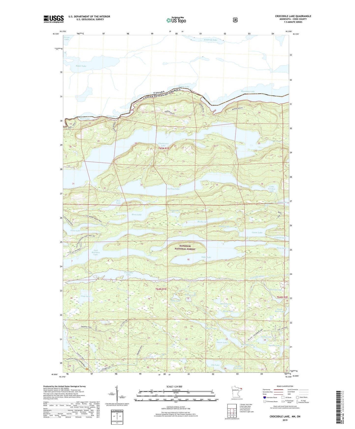
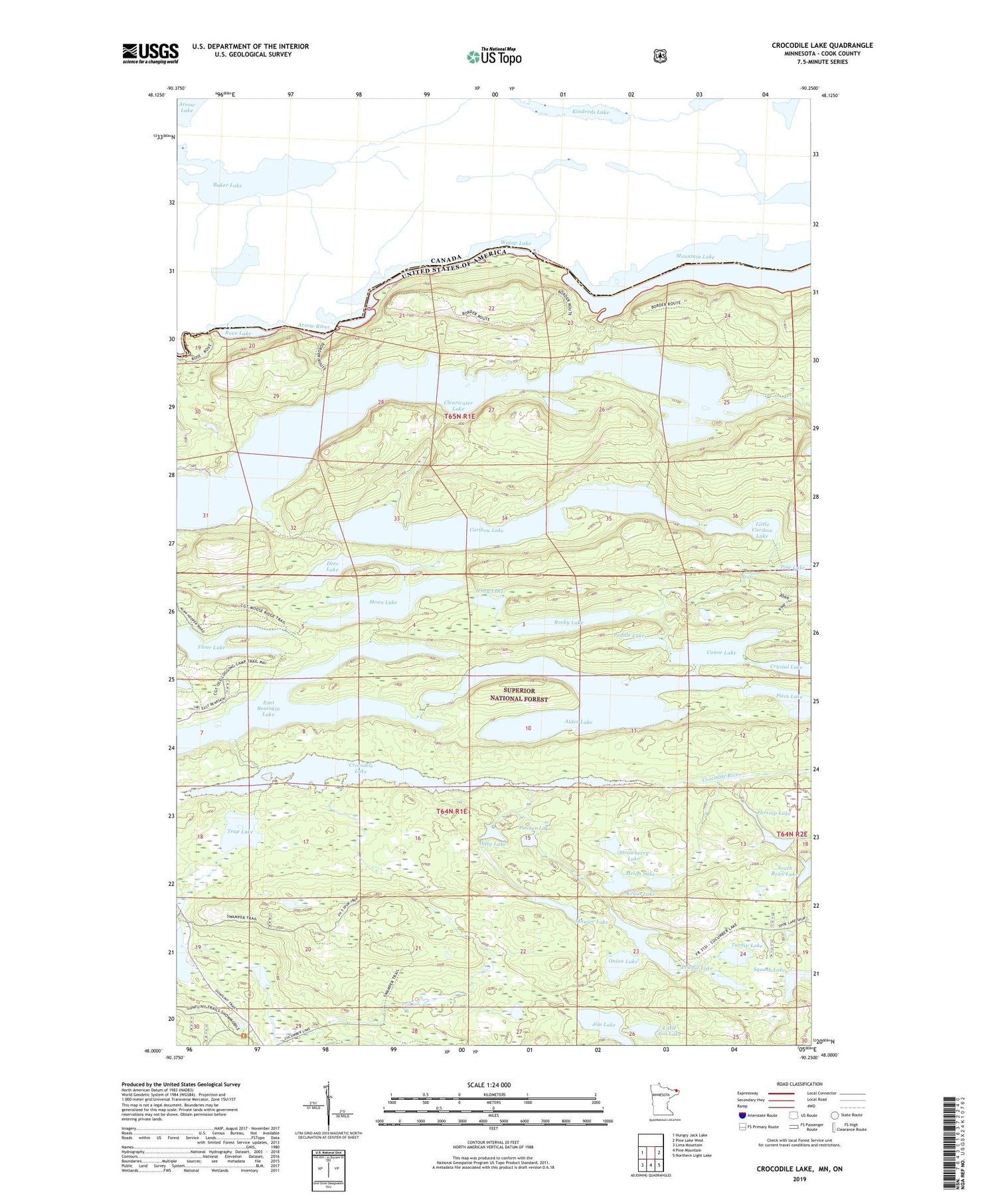
2019 topographic map quadrangle Crocodile Lake in the state of Minnesota. Scale: 1:24000. Based on the newly updated USGS 7.5' US Topo map series, this map is in the following counties: Cook. The map contains contour data, water features, and other items you are used to seeing on USGS maps, but also has updated roads and other features. This is the next generation of topographic maps. Printed on high-quality waterproof paper with UV fade-resistant inks.
Quads adjacent to this one:
West: Hungry Jack Lake
East: Pine Lake West
Southeast: Northern Light Lake
South: Pine Mountain
Southwest: Lima Mountain
Contains the following named places: Alder Lake, Canoe Lake, Caribou Lake, Clearwater Lake, Crocodile Lake, Crocodile River, Cucumber Lake, Deer Lake, Ditty Lake, East Bearskin Lake, Ivory Lake, Jim Lake, Johnson Falls, Kraut Lake, Little Caribou Lake, Little Jim Lake, Mauser Lake, Melon Lake, Moon Lake, Onion Lake, Paddle Lake, Parsnip Lake, Peanut Lake, Pierz Lake, Pitcher Lake, Rocky Lake, Rove Lake Post Office, South Bean Lake, Squash Lake, Strawberry Lake, Swamper Lake, Swamper Lake Parking and Boat Access, Trap Lake, Turnip Lake, Watap Lake