MyTopo
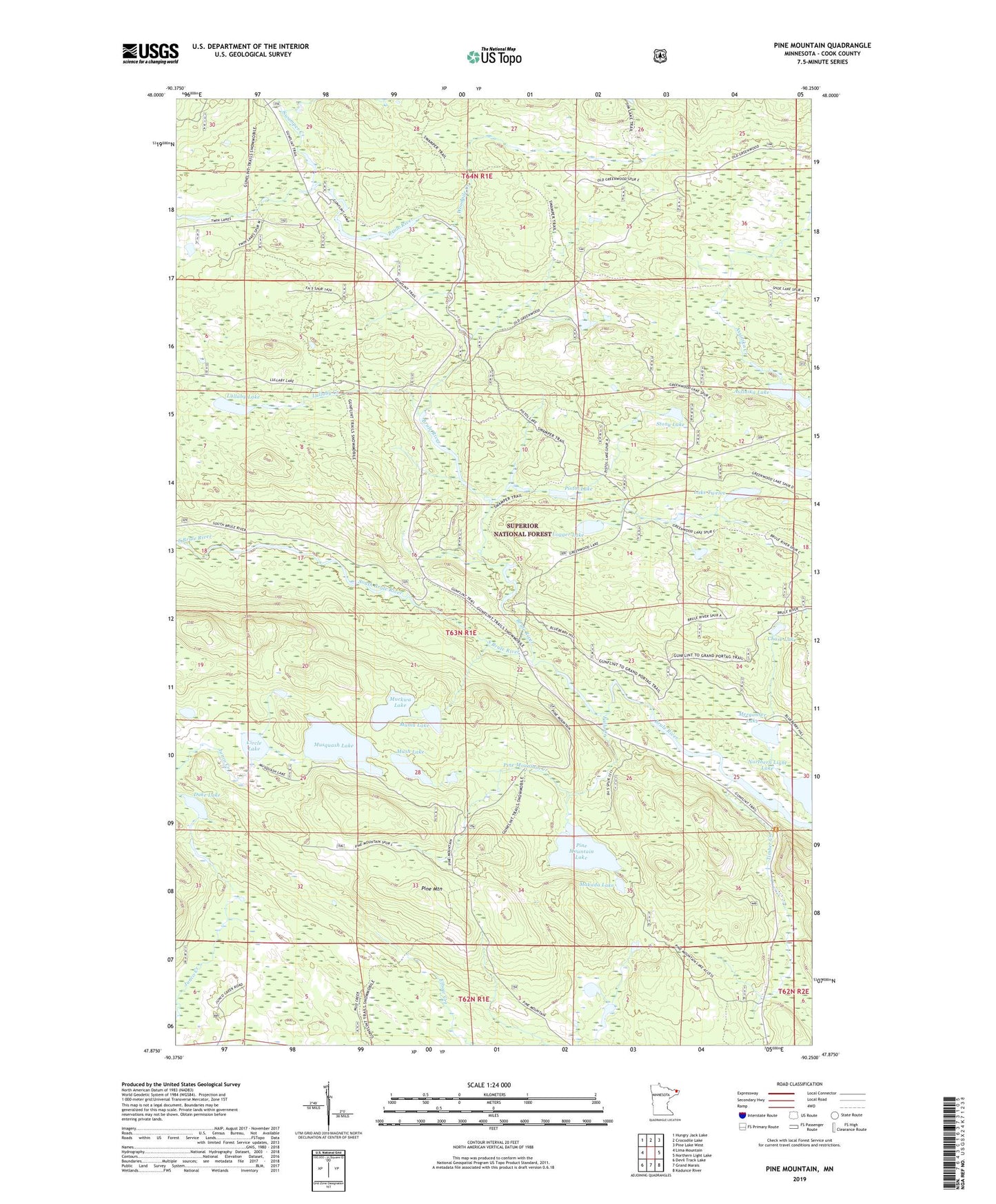
Pine Mountain Minnesota US Topo Map
Couldn't load pickup availability
Also explore the Pine Mountain Forest Service Topo of this same quad for updated USFS data
2022 topographic map quadrangle Pine Mountain in the state of Minnesota. Scale: 1:24000. Based on the newly updated USGS 7.5' US Topo map series, this map is in the following counties: Cook. The map contains contour data, water features, and other items you are used to seeing on USGS maps, but also has updated roads and other features. This is the next generation of topographic maps. Printed on high-quality waterproof paper with UV fade-resistant inks.
Quads adjacent to this one:
West: Lima Mountain
Northwest: Hungry Jack Lake
North: Crocodile Lake
Northeast: Pine Lake West
East: Northern Light Lake
Southeast: Kadunce River
South: Grand Marais
Southwest: Devil Track Lake
This map covers the same area as the classic USGS quad with code o47090h3.
Contains the following named places: Assinika Lake, Chase Lake, Circle Lake, Duke Lake, Falls Creek, Gunflint Camp, Lake Twelve, Logger Lake, Lullaby Creek, Lullaby Lake, Makada Lake, Merganser Lake, Muckwa Lake, Muma Lake, Mush Lake, Musquash Lake, Pine Mountain, Pine Mountain Creek, Pine Mountain Lake, Pistol Lake, South Brule River, Stony Lake, Swamper Creek, Timber Creek, Woodpile Creek