MyTopo
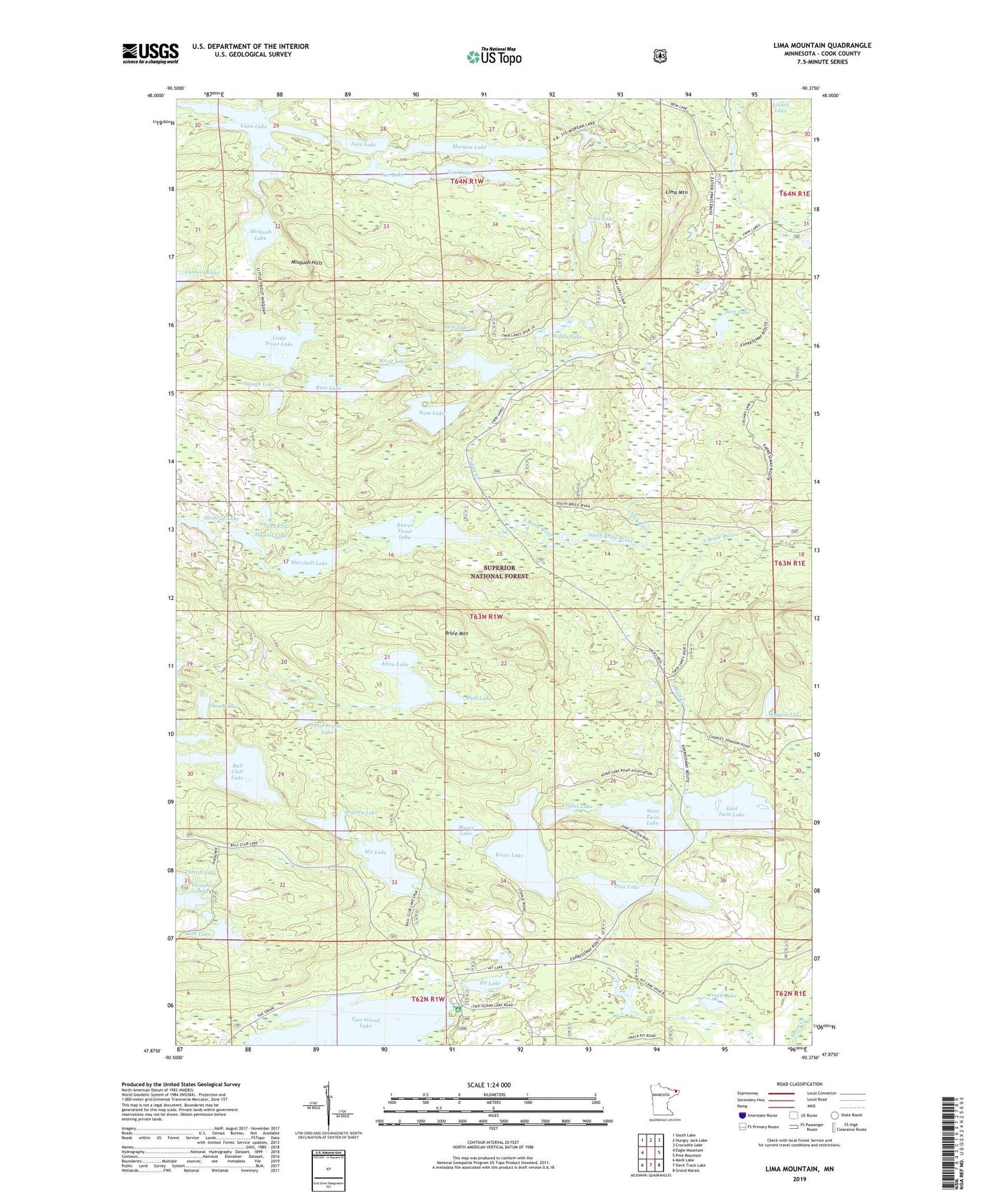
Lima Mountain Minnesota US Topo Map
Couldn't load pickup availability
Also explore the Lima Mountain Forest Service Topo of this same quad for updated USFS data
2022 topographic map quadrangle Lima Mountain in the state of Minnesota. Scale: 1:24000. Based on the newly updated USGS 7.5' US Topo map series, this map is in the following counties: Cook. The map contains contour data, water features, and other items you are used to seeing on USGS maps, but also has updated roads and other features. This is the next generation of topographic maps. Printed on high-quality waterproof paper with UV fade-resistant inks.
Quads adjacent to this one:
West: Eagle Mountain
Northwest: South Lake
North: Hungry Jack Lake
Northeast: Crocodile Lake
East: Pine Mountain
Southeast: Grand Marais
South: Devil Track Lake
Southwest: Mark Lake
This map covers the same area as the classic USGS quad with code o47090h4.
Contains the following named places: Abita Lake, Ball Club Lake, Bath Lake, Bluff Creek, Bower Trout Lake, Brule Mountain, Bulb Lake, Carl Lake, Dane Lake, Dislocation Lake, Dugout Lake, East Twin Lake, East/West Twin Boat Access, Eggers Lake, Fiddle Creek, Fiddle Lake, Iota Lake, Jake Lake, Kemo Lake, Kroft Lake, Lantern Lake, Lima Lake, Lima Mountain, Little Trout Lake, Lux Lake, Marshall Lake, Misquah Hills, Misquah Lake, Mit Lake, Morgan Lake, Moses Lake, Osprey Lake, Pine Lake, Pit Lake, Ptarmigan Lake, Ram Lake, Rum Lake, Sere Lake, Skidway Lake, Sled Lake, Slough Lake, Stickle Creek, Talus Lake, Thrasher Lake, Thrush Lake, Track Lake, Two Island Lake Campground, Vista Lake, West Twin Lake