
MyTopo
De Graff SE Minnesota US Topo Map
Couldn't load pickup availability
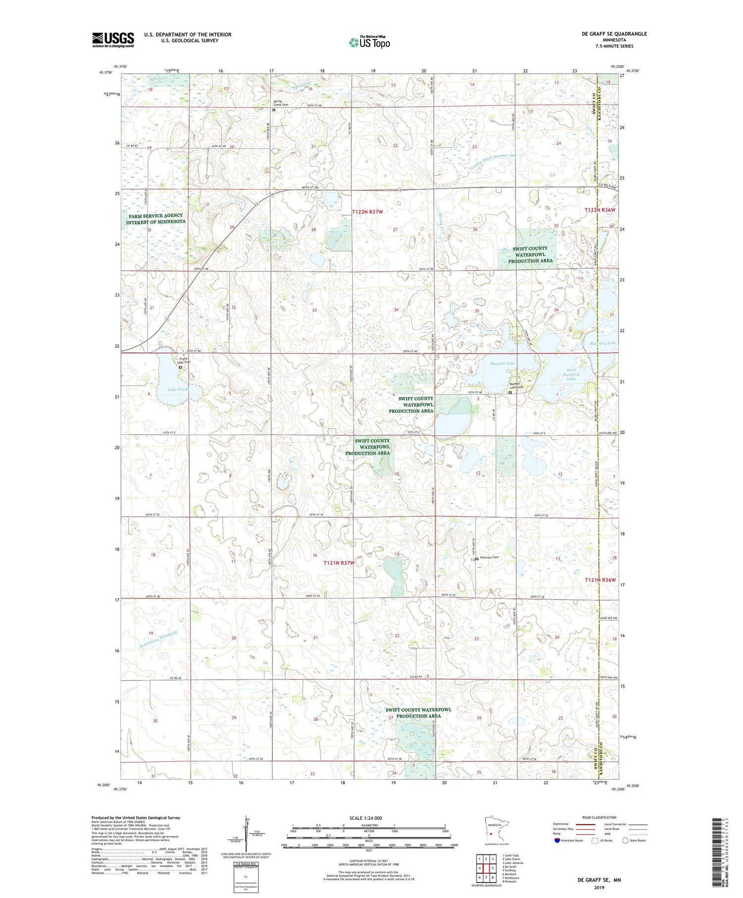
2019 topographic map quadrangle De Graff SE in the state of Minnesota. Scale: 1:24000. Based on the newly updated USGS 7.5' US Topo map series, this map is in the following counties: Swift, Kandiyohi. The map contains contour data, water features, and other items you are used to seeing on USGS maps, but also has updated roads and other features. This is the next generation of topographic maps. Printed on high-quality waterproof paper with UV fade-resistant inks.
Quads adjacent to this one:
West: De Graff
Northwest: Swift Falls
North: Lake Simon
Northeast: Lake Johanna
East: Sunburg
Southeast: Pennock
South: Kerkhoven
Southwest: Murdock
Contains the following named places: Camp Kerk State Wildlife Management Area, County Ditch Number One, County Ditch Number Sixtythree, Frank Lake Cemetery, Frank Lake Church, Hayes-Myhre State Wildlife Management Area, Hillcrest Cemetery, Lake Frank, Monson Lake, Monson Lake Church, Monson Lake Lutheran Church Cemetery, Monson Lake Memorial Historical Marker, Monson Lake Memorial State Park, Monson State Wildlife Management Areas, Spring Creek Cemetery, Spring Creek Church, Township of Hayes, Township of Kerkhoven, West Sunburg Lake


