MyTopo
Pennock Minnesota US Topo Map
Couldn't load pickup availability
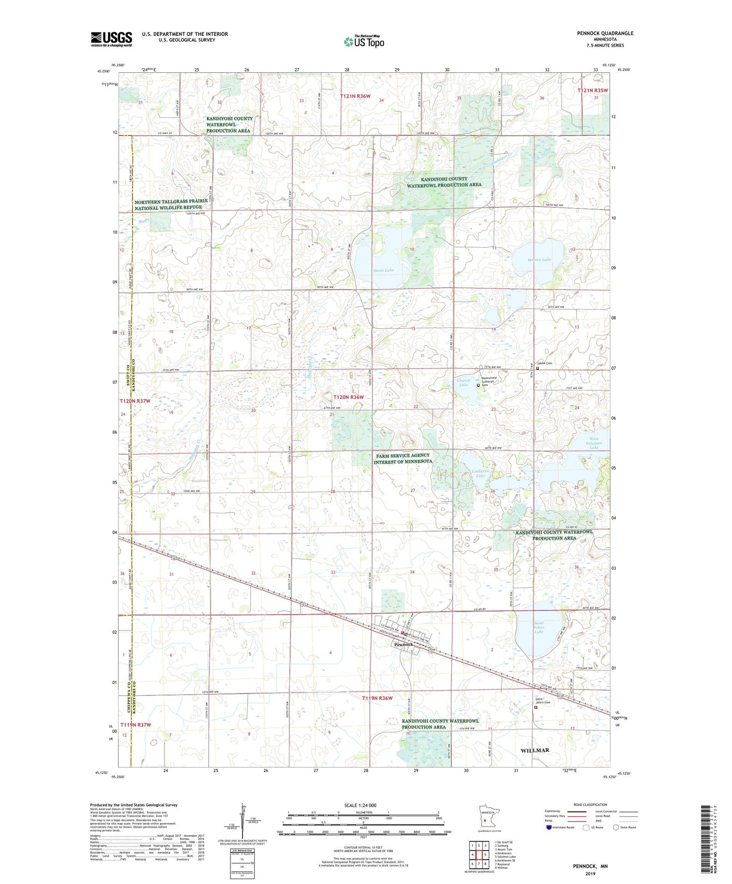
2022 topographic map quadrangle Pennock in the state of Minnesota. Scale: 1:24000. Based on the newly updated USGS 7.5' US Topo map series, this map is in the following counties: Kandiyohi, Swift, Chippewa. The map contains contour data, water features, and other items you are used to seeing on USGS maps, but also has updated roads and other features. This is the next generation of topographic maps. Printed on high-quality waterproof paper with UV fade-resistant inks.
Quads adjacent to this one:
West: Kerkhoven
Northwest: De Graff SE
North: Sunburg
Northeast: Mount Tom
East: Solomon Lake
Southeast: Willmar
South: Raymond
Southwest: Kerkhoven SE
This map covers the same area as the classic USGS quad with code o45095b2.
Contains the following named places: Church Lake, City of Pennock, East Park, Lindgren Lake, Mamre Lake, Mamre Lund Church, Mamrelund Lutheran Cemetery, Mamrelund Lutheran Church, Pennock, Pennock Fire Department, Pennock Post Office, Saint John's Cemetery, Saint Johns Church, Saint Johns Lake, Salem Cemetery, Salem Church, School Number 761 N, School Number 761 S, School Number 780, South Park, Swan Lake, Swan Lake Watershed Structure Dam, Township of Mamre, West Park, Youngren Dairy Farms, ZIP Code: 56279