MyTopo
Lake Simon Minnesota US Topo Map
Couldn't load pickup availability
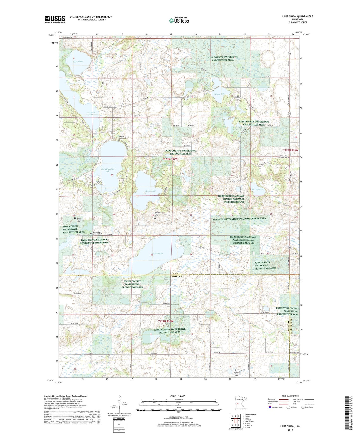
2022 topographic map quadrangle Lake Simon in the state of Minnesota. Scale: 1:24000. Based on the newly updated USGS 7.5' US Topo map series, this map is in the following counties: Pope, Swift, Kandiyohi. The map contains contour data, water features, and other items you are used to seeing on USGS maps, but also has updated roads and other features. This is the next generation of topographic maps. Printed on high-quality waterproof paper with UV fade-resistant inks.
Quads adjacent to this one:
West: Swift Falls
Northwest: Lake Minnewaska
North: Terrace
Northeast: Sedan
East: Lake Johanna
Southeast: Sunburg
South: De Graff SE
Southwest: De Graff
This map covers the same area as the classic USGS quad with code o45095d3.
Contains the following named places: Bakko Aviation, Bohmer Wildlife Pond Dam, Fort Lake Johanna and Iverson Cabin Historical Marker, Gilchrist Lake, Goose Lake, Hitman Family Cemetery, Johnson Lake, Lake Linka, Lake Simon, Nichols Farm Cemetery, Nilson Lake, Sather Family Cemetery, Sather Lake, Scandia Lutheran Cemetery, Scandinavian Lake, Seventh Day Adventist Cemetery, Spring Creek, Township of Gilchrist, West Lake Johanna Cemetery, West Lake Johanna Church