MyTopo
Dent Minnesota US Topo Map
Couldn't load pickup availability
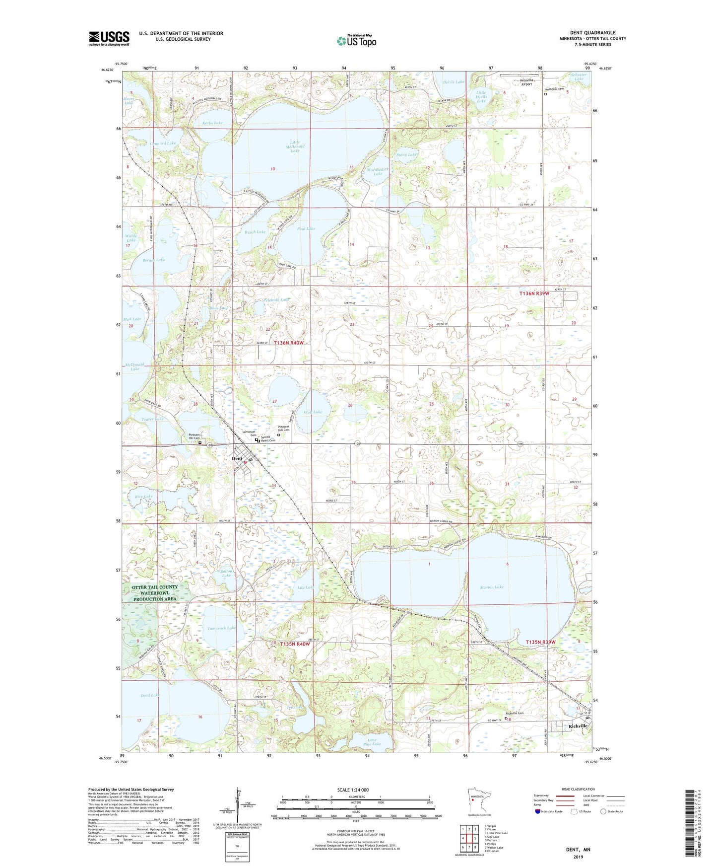
2019 topographic map quadrangle Dent in the state of Minnesota. Scale: 1:24000. Based on the newly updated USGS 7.5' US Topo map series, this map is in the following counties: Otter Tail. The map contains contour data, water features, and other items you are used to seeing on USGS maps, but also has updated roads and other features. This is the next generation of topographic maps. Printed on high-quality waterproof paper with UV fade-resistant inks.
Quads adjacent to this one:
West: Star Lake
Northwest: Vergas
North: Frazee
Northeast: Little Pine Lake
East: Perham
Southeast: Ottertail
South: Walker Lake
Southwest: Phelps
Contains the following named places: Aerovilla Airport, Berger Lake, Bolton Lake, Boos Lake, Ceynowa Lake, City of Dent, City of Richville, Dent, Dent Elementary School, Dent Fire Department, Dent Post Office, Frank's Campground, Grunard Lake, Immanuel Cemetery, Kerbs Lake, Kurtz Family Campground, Lily Lake, Little Devils Lake, Little McDonald Lake, Lone Pine Lake, Marion Lake, Memorial Cemetery, Mink Lake, Moenkedick Lake, Mud Lake, Paul Lake, Pelewski Lake, Pleasant Hill Cemetery, Rice Lake, Richville, Richville Cemetery, Richville Post Office, Richville Trailer Park, Rusch Lake, Sabbin Dairy Farm, Sacred Heart Cemetery, Sacred Heart Church, Schuster Lake, Star Hills Mobile Home Park, Stony Lake, Tamarack Lake, Tee Lake, Tenter Lake, Township of Edna, United Methodist Church, Walde Lake, Wolf Lake