MyTopo
Donnelly Minnesota US Topo Map
Couldn't load pickup availability
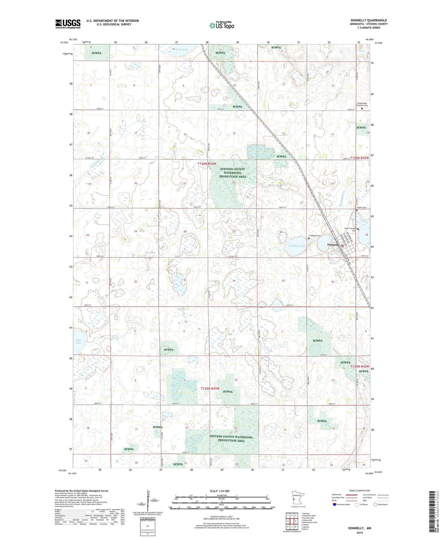
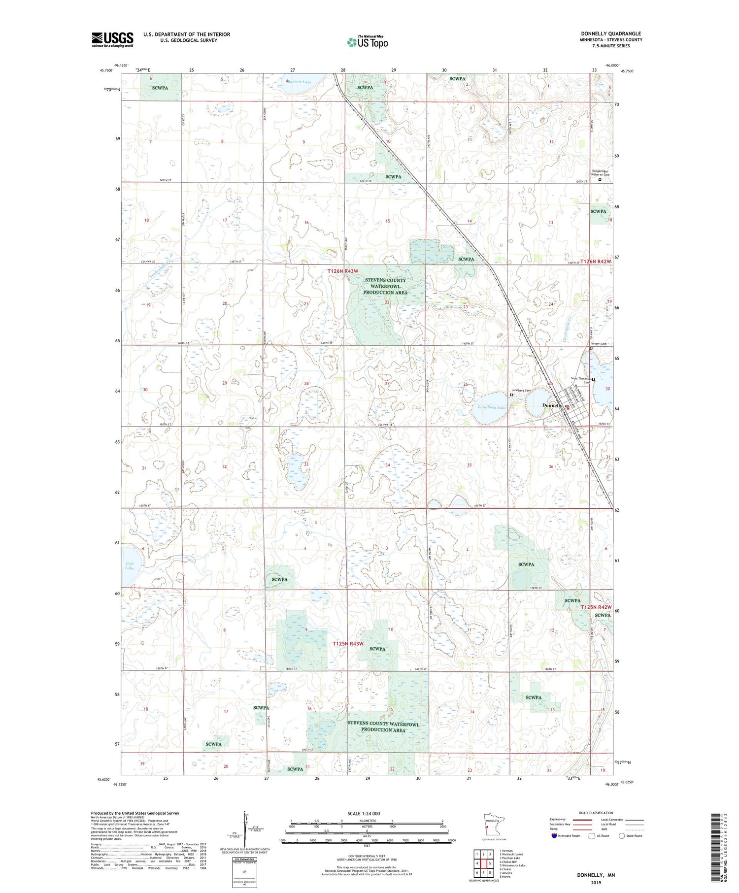
2019 topographic map quadrangle Donnelly in the state of Minnesota. Scale: 1:24000. Based on the newly updated USGS 7.5' US Topo map series, this map is in the following counties: Stevens. The map contains contour data, water features, and other items you are used to seeing on USGS maps, but also has updated roads and other features. This is the next generation of topographic maps. Printed on high-quality waterproof paper with UV fade-resistant inks.
Quads adjacent to this one:
West: Chokio NW
Northwest: Herman
North: Niemackl Lakes
Northeast: Patchen Lake
East: Wintermute Lake
Southeast: Morris
South: Alberta
Southwest: Chokio
Contains the following named places: Barrett Lake, City of Donnelly, County Ditch Number One, Donnelly, Donnelly Fire Department, Donnelly Post Office, Kline State Wildlife Management Area, Kongsvinger Church, Kongsvinger Lutheran Cemetery, Lundberg Cemetery, Lundberg Lake, Saint John's Lutheran Church, Saint Theresia Cemetery, School Number 15, School Number 42, School Number 44, School Number 56, School Number 63, Township of Donnelly, Township of Pepperton, Vinger Cemetery, ZIP Code: 56235