MyTopo
Niemackl Lakes Minnesota US Topo Map
Couldn't load pickup availability
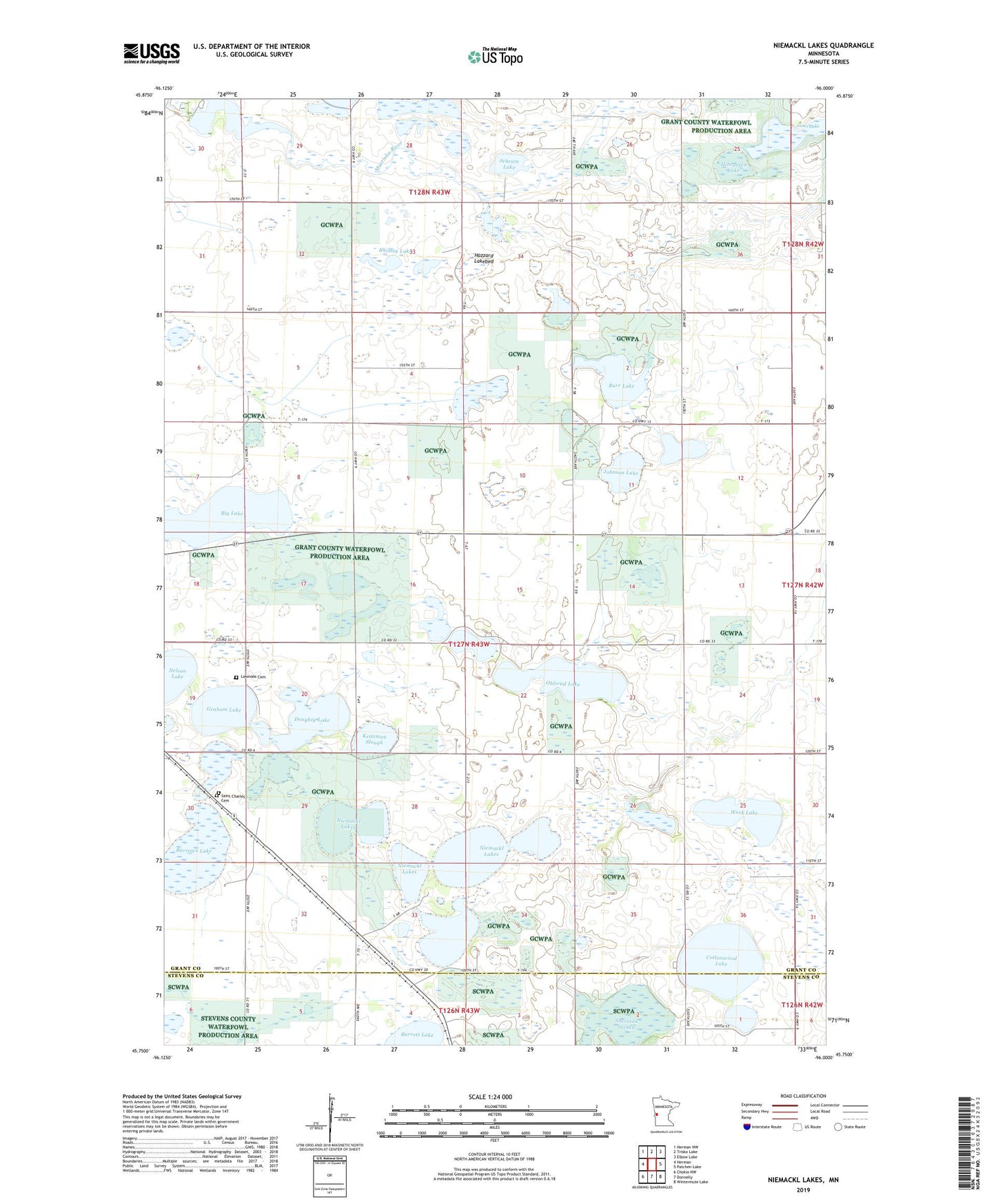
2022 topographic map quadrangle Niemackl Lakes in the state of Minnesota. Scale: 1:24000. Based on the newly updated USGS 7.5' US Topo map series, this map is in the following counties: Grant, Stevens. The map contains contour data, water features, and other items you are used to seeing on USGS maps, but also has updated roads and other features. This is the next generation of topographic maps. Printed on high-quality waterproof paper with UV fade-resistant inks.
Quads adjacent to this one:
West: Herman
Northwest: Herman NW
North: Trisko Lake
Northeast: Elbow Lake
East: Patchen Lake
Southeast: Wintermute Lake
South: Donnelly
Southwest: Chokio NW
This map covers the same area as the classic USGS quad with code o45096g1.
Contains the following named places: Barrows Lake, Big Lake, Burr Lake, Cottonwood Lake, Doughty Lake, Graham Lake, Hazzard Lakebed, Helsene State Wildlife Management Area, Hibrooten Lake, Johnson Lake, Jones Lake, Keitzman Slough, Lakeside Cemetery, Macsville State Wildlife Management Area, Moose Island, Moose Island Post Office, Mustinka Dam, Mustinka Flowage, Mustinka River Dam, Mustinka River Reservoir, Nelson Lake, Niemackl Lake Park Campground, Niemackl Lakes, Ohlsrud Lake, Pine Ridge Park, Rhimey Lake, Saint Charles Cemetery, School Number 19, School Number 21, School Number 58, School Number 62, Schram Lake, Sherstad Slough, Towner State Wildlife Management Area, Township of Macsville, Werk Lake, Wilts State Wildlife Management Area