MyTopo
Chokio NW Minnesota US Topo Map
Couldn't load pickup availability
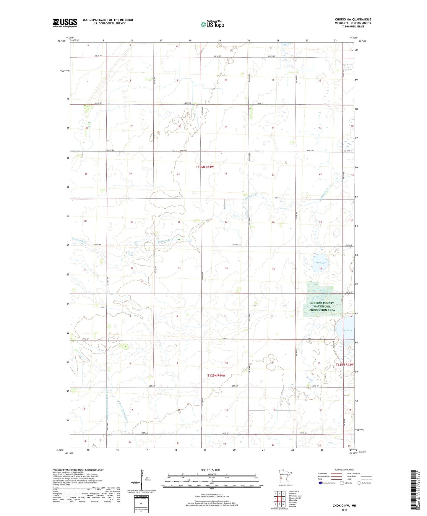
2022 topographic map quadrangle Chokio NW in the state of Minnesota. Scale: 1:24000. Based on the newly updated USGS 7.5' US Topo map series, this map is in the following counties: Stevens. The map contains contour data, water features, and other items you are used to seeing on USGS maps, but also has updated roads and other features. This is the next generation of topographic maps. Printed on high-quality waterproof paper with UV fade-resistant inks.
Quads adjacent to this one:
West: Graceville NE
Northwest: Wheaton SE
North: Herman
Northeast: Niemackl Lakes
East: Donnelly
Southeast: Alberta
South: Chokio
Southwest: Johnson
This map covers the same area as the classic USGS quad with code o45096f2.
Contains the following named places: Boekholt Grove State Wildlife Management, Everglade State Wildlife Management Area, Fish Lake, Hornings Pit State Wildlife Management Ar, Mud Lake, School Number 35, School Number 43, School Number 46, School Number 51, School Number 61, School Number 68, Thedin State Wildlife Management Area, Township of Eldorado, Township of Everglade