MyTopo
Edgerton North Minnesota US Topo Map
Couldn't load pickup availability
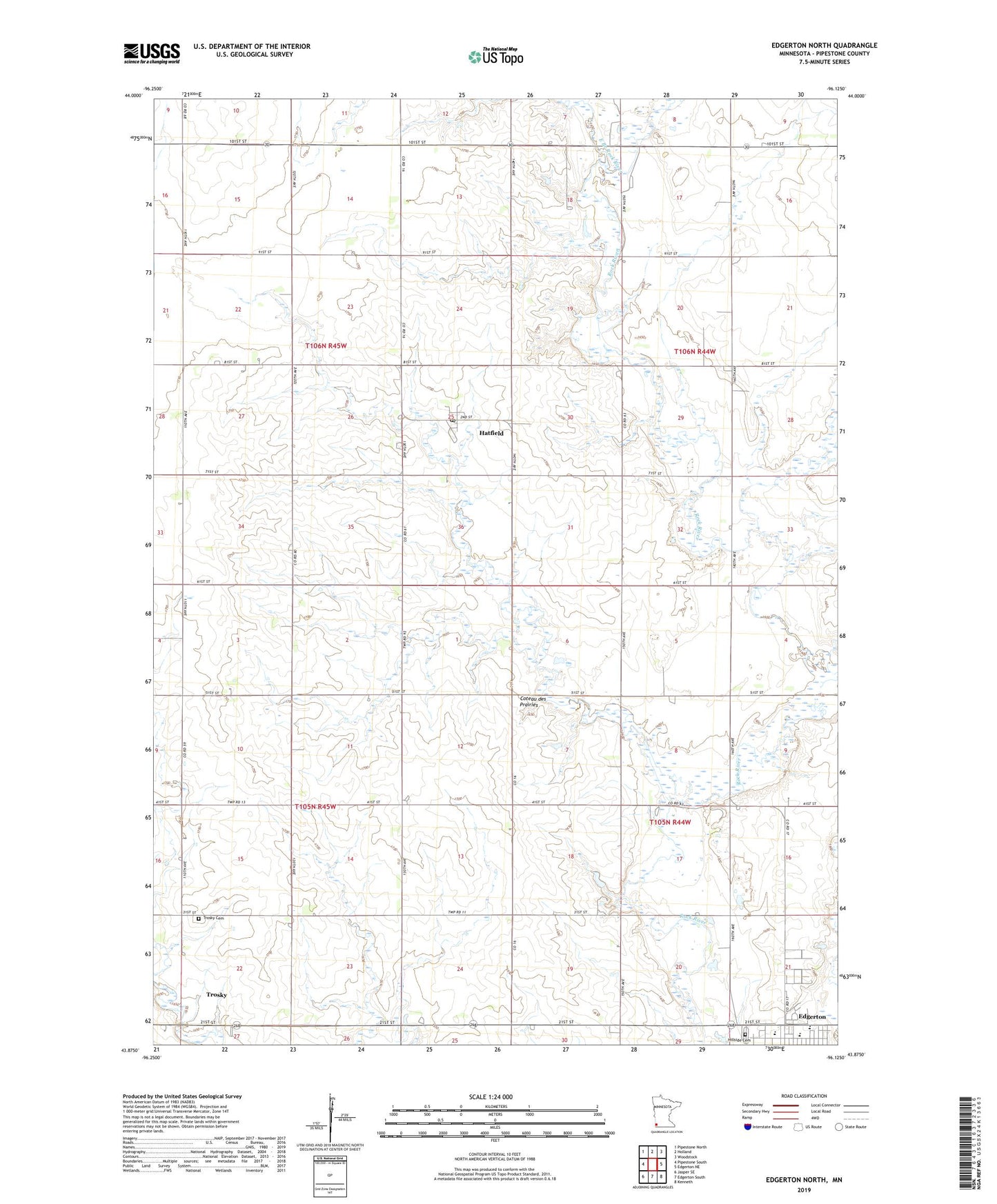
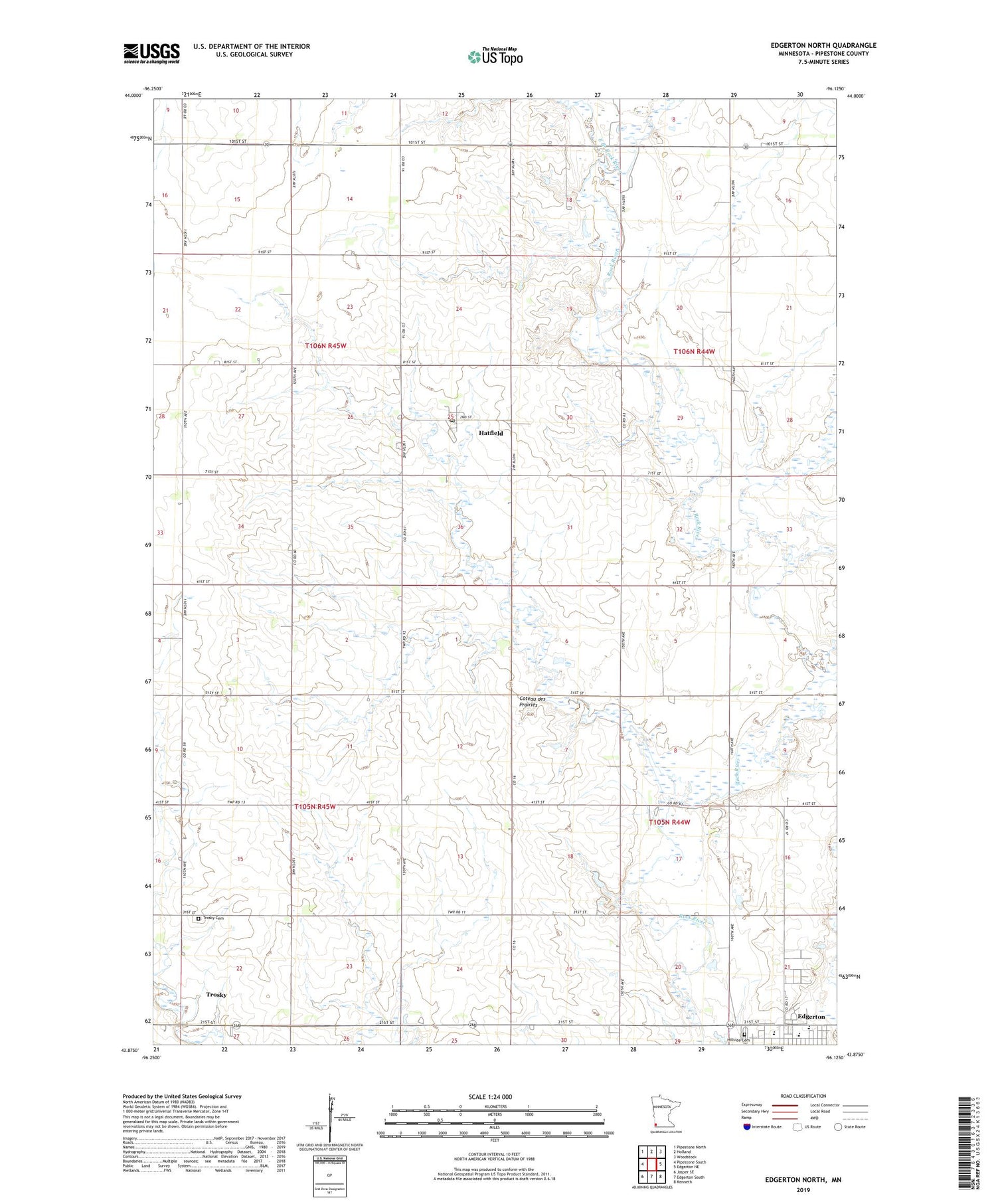
2019 topographic map quadrangle Edgerton North in the state of Minnesota. Scale: 1:24000. Based on the newly updated USGS 7.5' US Topo map series, this map is in the following counties: Pipestone. The map contains contour data, water features, and other items you are used to seeing on USGS maps, but also has updated roads and other features. This is the next generation of topographic maps. Printed on high-quality waterproof paper with UV fade-resistant inks.
Quads adjacent to this one:
West: Pipestone South
Northwest: Pipestone North
North: Holland
Northeast: Woodstock
East: Edgerton NE
Southeast: Kenneth
South: Edgerton South
Southwest: Jasper SE
Contains the following named places: Bethel Christian Reformed Church, Burke State Wildlife Management Area, City of Edgerton, City of Hatfield, East Branch Rock River, Edgerton Family Medical Clinic, Edgerton Free Christian School, Edgerton Public High School, First Christian Reformed Church, First Presbyterian Church, Hatfield, Hatfield Post Office, Hillside Cemetery, Howard Snyder Farm Pond Dam, Newalta Dairy, R and R Acres, Ranger Farms, Shaffer Farms, Southwest Christian High School, Township of Elmer, Township of Gray, Trosky Cemetery