MyTopo
Pipestone North Minnesota US Topo Map
Couldn't load pickup availability
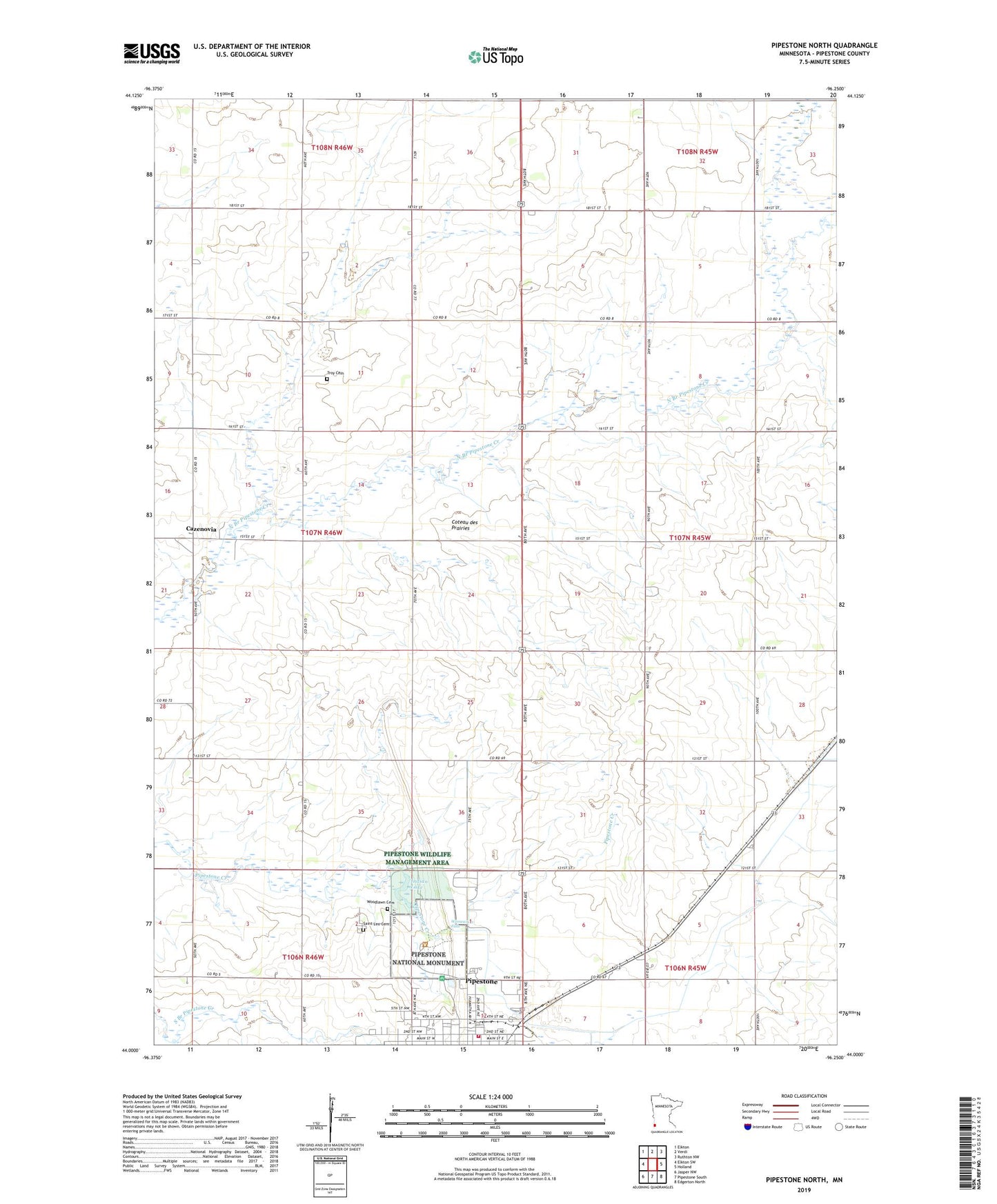
2022 topographic map quadrangle Pipestone North in the state of Minnesota. Scale: 1:24000. Based on the newly updated USGS 7.5' US Topo map series, this map is in the following counties: Pipestone. The map contains contour data, water features, and other items you are used to seeing on USGS maps, but also has updated roads and other features. This is the next generation of topographic maps. Printed on high-quality waterproof paper with UV fade-resistant inks.
Quads adjacent to this one:
West: Elkton SW
Northwest: Elkton
North: Verdi
Northeast: Ruthton NW
East: Holland
Southeast: Edgerton North
South: Pipestone South
Southwest: Jasper NW
This map covers the same area as the classic USGS quad with code o44096a3.
Contains the following named places: Cazenovia, Cazenovia Post Office, Christ the King Lutheran Church, Christ the King Lutheran School, Good Samaritan Village, Indian Lake, Leon H Moore Park, Minnesota West Community and Technical College - Pipestone Campus, Nicollet Expedition Historical Marker, Paulsen Angus Farms, Perkins Lazy Meadows Airport, Pipestone, Pipestone County, Pipestone Indian State Wildlife Management A, Pipestone National Monument, Pipestone RV Campground, Pipestone Volunteer Fire Department, Pipestone Wildlife Management Area, Saint Leo Cemetery, Saint Paul Lutheran Church, Troy Cemetery, Troy State Wildlife Management Area, Veterans Park, Westview Park, Winnewissa Falls, Woodlawn Cemetery, ZIP Code: 56164