MyTopo
Elba Minnesota US Topo Map
Couldn't load pickup availability
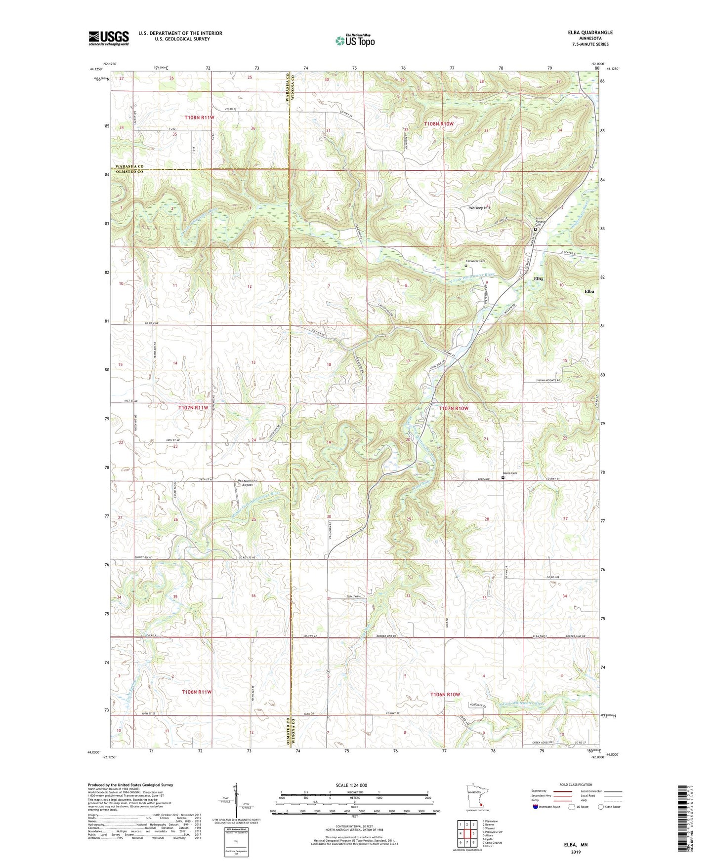
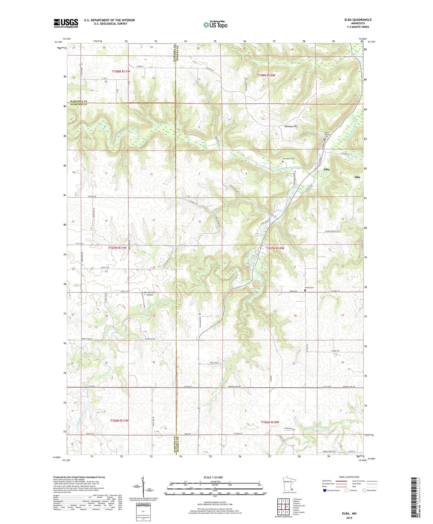
2019 topographic map quadrangle Elba in the state of Minnesota. Scale: 1:24000. Based on the newly updated USGS 7.5' US Topo map series, this map is in the following counties: Winona, Olmsted, Wabasha. The map contains contour data, water features, and other items you are used to seeing on USGS maps, but also has updated roads and other features. This is the next generation of topographic maps. Printed on high-quality waterproof paper with UV fade-resistant inks.
Quads adjacent to this one:
West: Plainview SW
Northwest: Plainview
North: Beaver
Northeast: Weaver
East: Altura
Southeast: Utica
South: Saint Charles
Southwest: Eyota
Contains the following named places: Berea Cemetery, Berea Church, City of Elba, Crow Spring, Elba, Elba Post Office, Fairwater Cemetery, Kingsley Corner, Lazy D Campground, Middle Fork Whitewater River, North Fork Whitewater River, Saint Aloysius Cemetery, Saint Aloysius Church, South Fork Whitewater River, Township of Elba, Trout Run, Van Norman's Airport, Whiskey Hill, Whitewater State Park, Whitewater State Park Historical Marker