MyTopo
Altura Minnesota US Topo Map
Couldn't load pickup availability
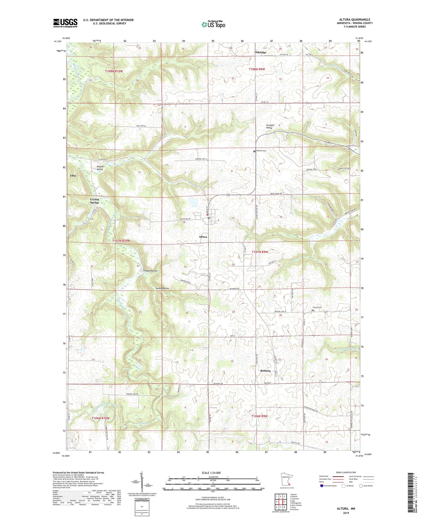
2022 topographic map quadrangle Altura in the state of Minnesota. Scale: 1:24000. Based on the newly updated USGS 7.5' US Topo map series, this map is in the following counties: Winona. The map contains contour data, water features, and other items you are used to seeing on USGS maps, but also has updated roads and other features. This is the next generation of topographic maps. Printed on high-quality waterproof paper with UV fade-resistant inks.
Quads adjacent to this one:
West: Elba
Northwest: Beaver
North: Weaver
Northeast: Cochrane
East: Rollingstone
Southeast: Lewiston
South: Utica
Southwest: Saint Charles
This map covers the same area as the classic USGS quad with code o44091a8.
Contains the following named places: Altura, Altura Elementary School, Altura Fire Department, Altura Post Office, Bethany, Bethany Church, Bethany Post Office, Chaffe Ravine, City of Altura, Crystal Spring, Hebron Cemetery, Hebron Church, Holt Spring, Kieffer Valley, Lake Horn, Lenard Greden Detention Dam, Oakridge, Oakridge Post Office, Richard J Dorer Memorial Hardwood State Forest, Saint Anthony Catholic Church, Saint Mary's Church, Sweet Ravine, Township of Norton, Trinity Cemetery, Trinity Church, ZIP Code: 55969