MyTopo
Rothsay Minnesota US Topo Map
Couldn't load pickup availability
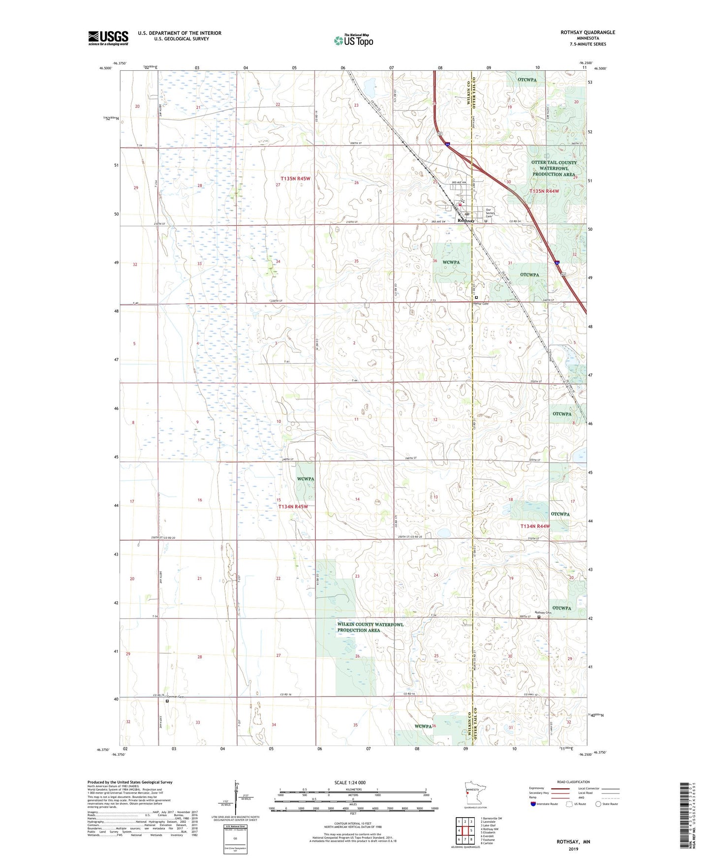
2022 topographic map quadrangle Rothsay in the state of Minnesota. Scale: 1:24000. Based on the newly updated USGS 7.5' US Topo map series, this map is in the following counties: Wilkin, Otter Tail. The map contains contour data, water features, and other items you are used to seeing on USGS maps, but also has updated roads and other features. This is the next generation of topographic maps. Printed on high-quality waterproof paper with UV fade-resistant inks.
Quads adjacent to this one:
West: Rothsay NW
Northwest: Barnesville SW
North: Lawndale
Northeast: Lake Olaf
East: Elizabeth
Southeast: Carlisle
South: Foxhome
Southwest: Everdell
This map covers the same area as the classic USGS quad with code o46096d3.
Contains the following named places: Akron State Wildlife Management Area, City of Rothsay, German Cemetery, Hamar Cemetery, Hamar Lutheran Church, Our Saviors Cemetery, Our Savior's Church, Rothsay, Rothsay Baptist Cemetery, Rothsay Baptist Church, Rothsay Fire Department, Rothsay Mobile Home Park, Rothsay Post Office, Rothsay School, School Number 260, School Number 28, School Number 4, School Number 5, Township of Akron, ZIP Code: 56579