MyTopo
Emily Minnesota US Topo Map
Couldn't load pickup availability
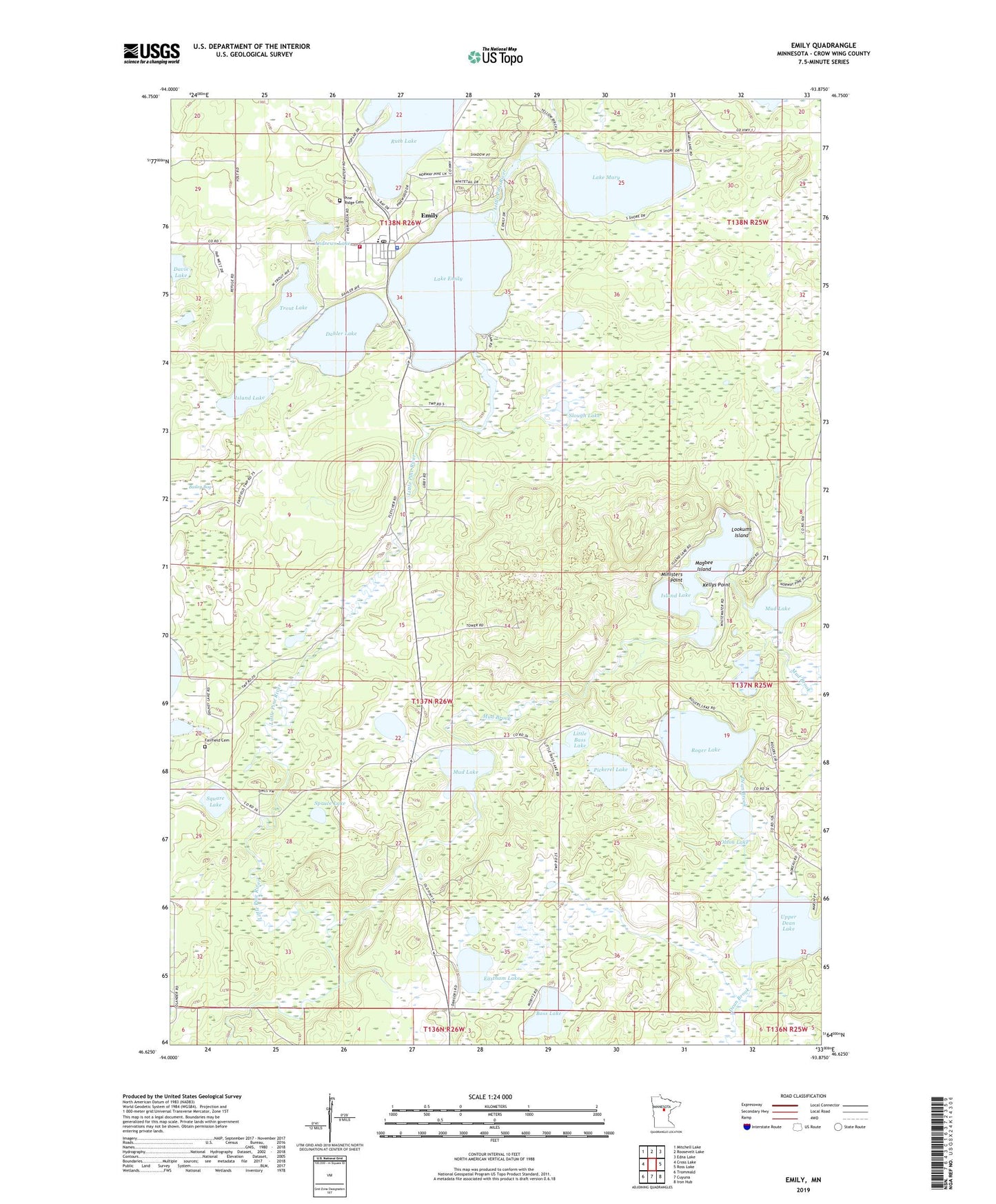
2019 topographic map quadrangle Emily in the state of Minnesota. Scale: 1:24000. Based on the newly updated USGS 7.5' US Topo map series, this map is in the following counties: Crow Wing. The map contains contour data, water features, and other items you are used to seeing on USGS maps, but also has updated roads and other features. This is the next generation of topographic maps. Printed on high-quality waterproof paper with UV fade-resistant inks.
Quads adjacent to this one:
West: Cross Lake
Northwest: Mitchell Lake
North: Roosevelt Lake
Northeast: Edna Lake
East: Ross Lake
Southeast: Iron Hub
South: Cuyuna
Southwest: Trommald
Contains the following named places: Andrews Lake, Bailey Bog, Bass Lake, Dahler Lake, Eastham Lake, Emily, Emily City Hall, Emily Greens Golf Course, Emily Lake Dam, Emily Lookout Tower, Emily Police Department, Emily Post Office, Emily State Forest, Emily Volunteer Fire Department, Emily Wayside Park, Fairfield Cemetery, Island Lake, Island Lake Dam, Kellys Point, Lake Emily, Lake Emily Resort and Campground, Lake Mary, Little Bass Lake, Lookums Island, Magbee Island, Ministers Point, Mud Brook, Mud Lake, Olson Lake, Pickerel Lake, Pine Ridge Cemetery, Roger Lake, Ruth Lake, Saint Emily Catholic Church, Slough Lake, Spruce Lake, Square Lake, Township of Fairfield, Trout Lake, Upper Dean Lake, Upper Dean State Wildlife Management Area, Van Sickle Brook, ZIP Code: 56447