MyTopo
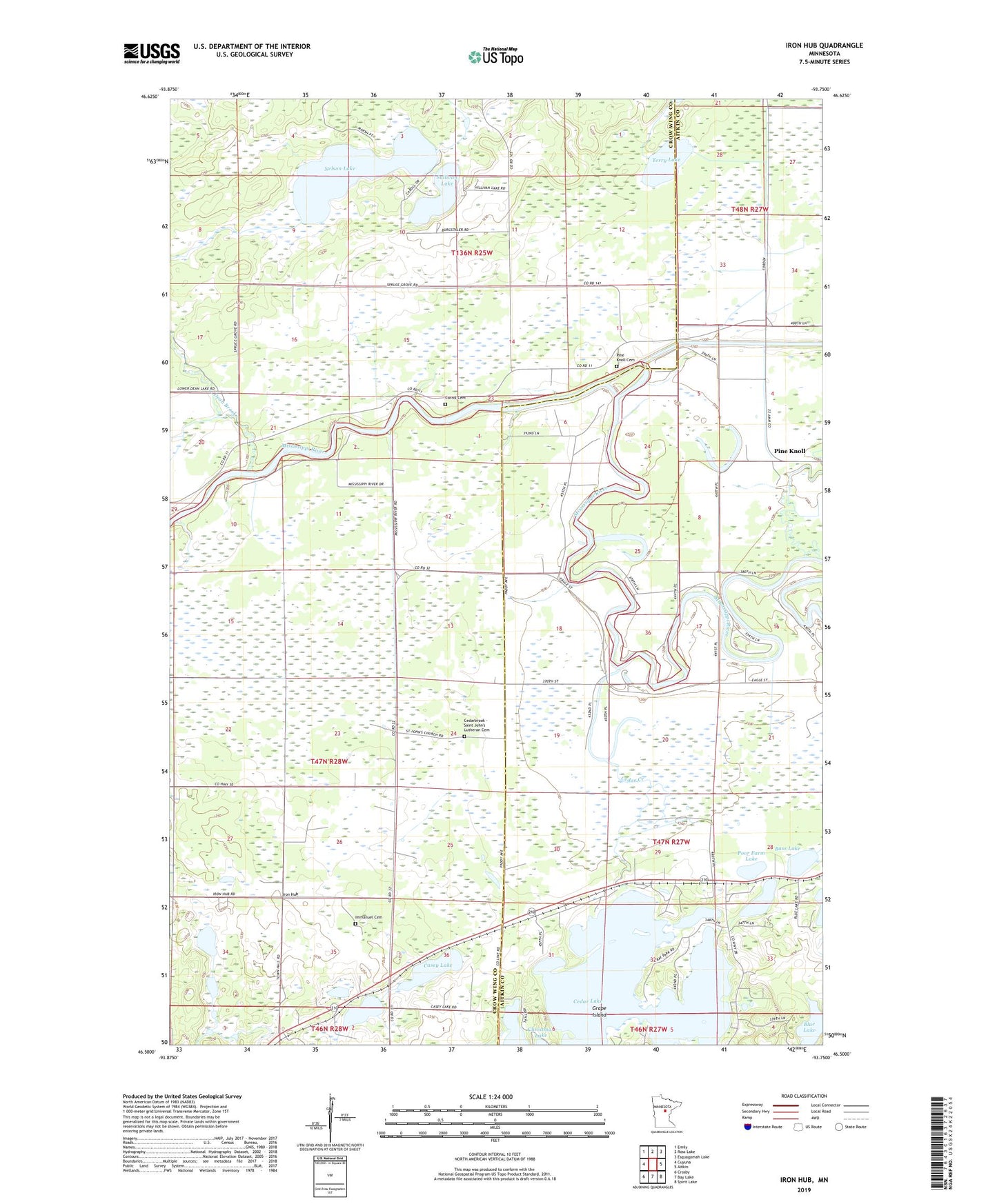
Iron Hub Minnesota US Topo Map
Couldn't load pickup availability
2022 topographic map quadrangle Iron Hub in the state of Minnesota. Scale: 1:24000. Based on the newly updated USGS 7.5' US Topo map series, this map is in the following counties: Crow Wing, Aitkin. The map contains contour data, water features, and other items you are used to seeing on USGS maps, but also has updated roads and other features. This is the next generation of topographic maps. Printed on high-quality waterproof paper with UV fade-resistant inks.
Quads adjacent to this one:
West: Cuyuna
Northwest: Emily
North: Ross Lake
Northeast: Esquagamah Lake
East: Aitkin
Southeast: Spirit Lake
South: Bay Lake
Southwest: Crosby
This map covers the same area as the classic USGS quad with code o46093e7.
Contains the following named places: Bass Lake, Blue Lake, Carrol Cemetery, Casey Lake, Cedar Creek, Cedar Lake, Dean Brook, Dogfish Lake, Edgewater Resort and RV Park, Grape Island, Immanuel Cemetery, Immanuel Lutheran Church, Iron Hub, Iron Hub Post Office, KEZZ-FM (Aitkin), Little Willow River, Nelson Lake, Pine Knoll, Pine Knoll Cemetery, Pineknoll Post Office, Poor Farm Lake, Rushmeyer Lake, Saint Johns Church, Saint Johns Lutheran Cemetery, Sullivan Lake, Terry Lake, Township of Aitkin, Township of Dean Lake, Township of Rabbit Lake, Unorganized Territory of Second Assessment