MyTopo
Mitchell Lake Minnesota US Topo Map
Couldn't load pickup availability
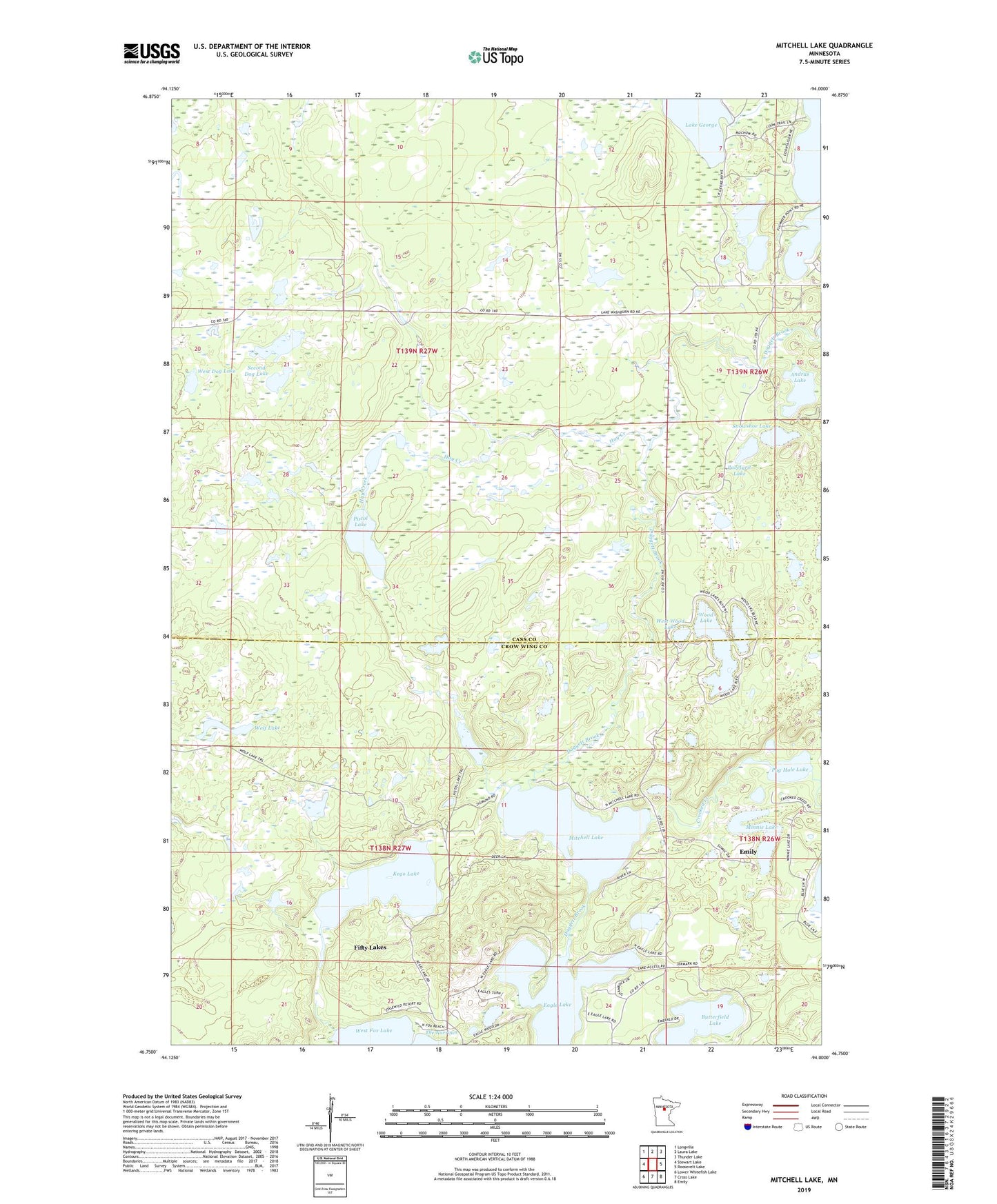
2022 topographic map quadrangle Mitchell Lake in the state of Minnesota. Scale: 1:24000. Based on the newly updated USGS 7.5' US Topo map series, this map is in the following counties: Cass, Crow Wing. The map contains contour data, water features, and other items you are used to seeing on USGS maps, but also has updated roads and other features. This is the next generation of topographic maps. Printed on high-quality waterproof paper with UV fade-resistant inks.
Quads adjacent to this one:
West: Stewart Lake
Northwest: Longville
North: Laura Lake
Northeast: Thunder Lake
East: Roosevelt Lake
Southeast: Emily
South: Cross Lake
Southwest: Lower Whitefish Lake
This map covers the same area as the classic USGS quad with code o46094g1.
Contains the following named places: Andrus Lake, Butterfield Lake, City of Fifty Lakes, Crooked Creek, Daggett Brook, Eagle Lake, East Wood Lake, First Dog Lake, George Lake, George Lake Dam, Golden Eagle Golf Club, Hay Creek, Kego Lake, Minnie Lake, Mitchell Lake, Pavelgrit Lake, Pistol Lake, Pug Hole Lake, Second Dog Lake, Snowshoe Lake, West Dog Lake, West Wood Lake, Wolf Lake, Wood Lake, ZIP Code: 56448