MyTopo
Roosevelt Lake Minnesota US Topo Map
Couldn't load pickup availability
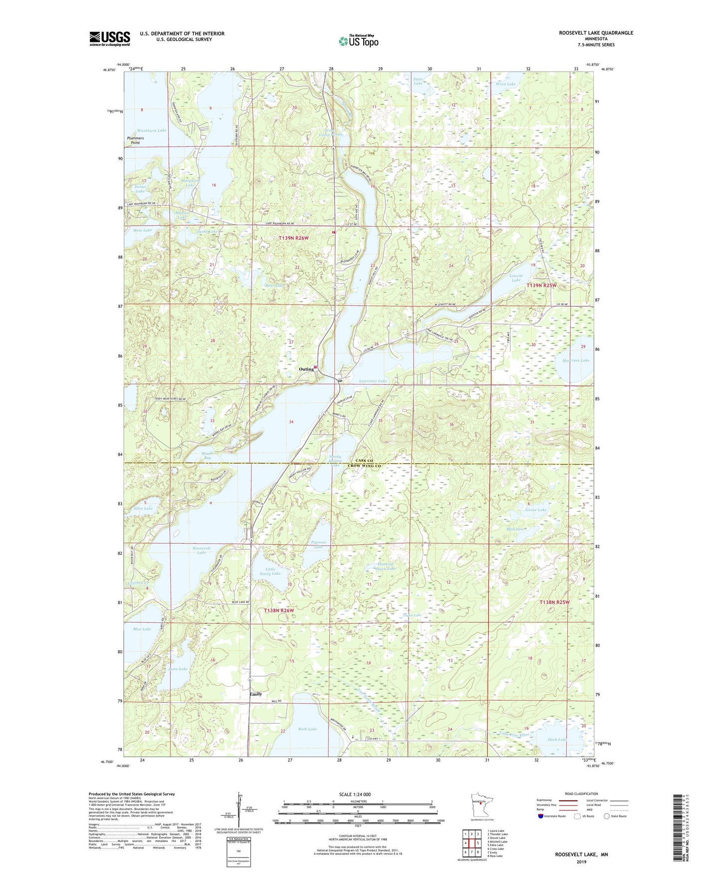
2022 topographic map quadrangle Roosevelt Lake in the state of Minnesota. Scale: 1:24000. Based on the newly updated USGS 7.5' US Topo map series, this map is in the following counties: Cass, Crow Wing. The map contains contour data, water features, and other items you are used to seeing on USGS maps, but also has updated roads and other features. This is the next generation of topographic maps. Printed on high-quality waterproof paper with UV fade-resistant inks.
Quads adjacent to this one:
West: Mitchell Lake
Northwest: Laura Lake
North: Thunder Lake
Northeast: Shovel Lake
East: Edna Lake
Southeast: Ross Lake
South: Emily
Southwest: Cross Lake
This map covers the same area as the classic USGS quad with code o46093g8.
Contains the following named places: Allen Lake, Anna Lake, Bear Lake, Birch Bay Campground, Blue Lake, City of Emily, Cornerstone Christian School, Crooked Lake Volunteer Fire Department Canister Station, Department of Natural Resources Division of Forestry - Washburn Lake Ranger Station, Donut Lake, Duck Lake, Duck Lake Dam, Duck Lake State Wildlife Management Area, Emily Charter School, Emily Wesleyan Church, Goose Lake, Grasshopper Lake, Hunting Shack Lake, Lawrence Lake, Leavitt Lake, Little Emily Lake, Margaret Lake, Marion Lake, Morrison Lake, Mud Lake, Mule Lake, Outing, Outing Post Office, Outing Wayside Park, Papoose Lake, Plummers Point, Roosevelt Lake, Scout Camp Pond, Smoky Hollow Lake, Snake Lake, Spring Branch, State Lake, Taylor Lake, Thom's Resort and Campground, Township of Crooked Lake, Washburn Lake, Washburn Lake Campground, Woods Bay, Woods Lake, Wren Lake