MyTopo
Esquagamah Lake Minnesota US Topo Map
Couldn't load pickup availability
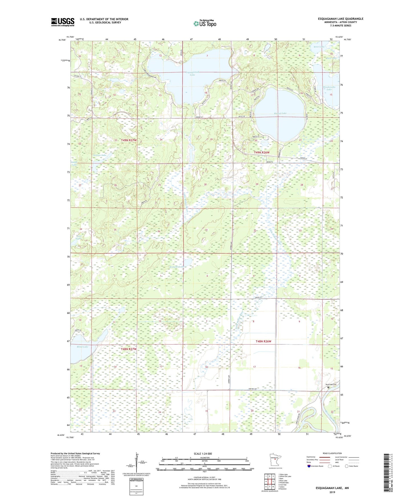
2019 topographic map quadrangle Esquagamah Lake in the state of Minnesota. Scale: 1:24000. Based on the newly updated USGS 7.5' US Topo map series, this map is in the following counties: Aitkin. The map contains contour data, water features, and other items you are used to seeing on USGS maps, but also has updated roads and other features. This is the next generation of topographic maps. Printed on high-quality waterproof paper with UV fade-resistant inks.
Quads adjacent to this one:
West: Ross Lake
Northwest: Edna Lake
North: White Elk Lake
Northeast: Bain
East: Waukenabo
Southeast: Hassman
South: Aitkin
Southwest: Iron Hub
Contains the following named places: Avenue Lake, Blind Lake, Esquagamah Lake, Hill Top Chapel, Krilwitz Lake, Little Willow River, Little Willow River Dam, Little Willow River Wildlife Area Dam, Little Willow State Wildlife Management Area, Lizer Lake, Rice Portage Lake, Rice Portage Lake Dam, Riverside Cemetery, Round Lake, Tamarack, Township of Morrison, Township of Waukenabo, Waukenabo Lake, Waukenabo Lake Dam, West Lake